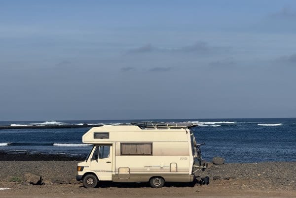

The GR131 across Fuerteventura is a 150 km long-distance hiking trail. It's part of the larger GR131 that crosses the Canary Islands. It runs the whole length of the island. It starts in Corralejo in the north and ends at the lighthouse at Punta de Jandía in the south.
The whole archipelago, island by island, with the ferries and buses between them, is in my GR131 Canary Islands guide.
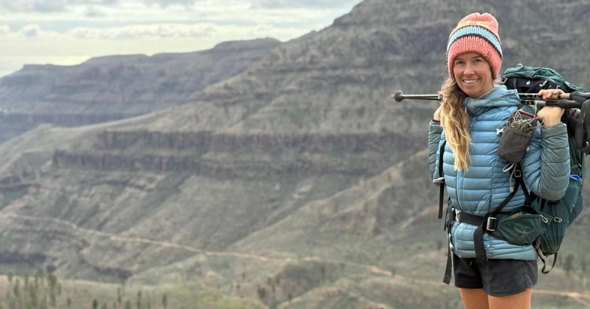
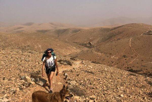
I walked it in winter 2022. With Jonatan and my dog Wingo. We carried our own food, water and camping gear. It was my first self-sufficient long-distance hike. I had a borrowed backpack, an old sleeping bag and running shoes. And absolutely no idea how much this walk would change the way I travel.
The trail is well waymarked with the red and white GR stripes. It's fairly easy to navigate. What's most challenging is the sun. Sometimes the wind too. And you need to plan your water well. But it's definitely doable. The trail passes lots of villages.
Updated October 2026. Based on my thru-hike in 2022 and later trips back to the island.
Download the route and open the map
Get the Wikiloc GPX track for offline navigation. Or open the full route on AllTrails to see the map and the elevation profile. How I navigate it is further down.
Trail snapshot
| Distance | Around 150 km, Corralejo to Punta de Jandía |
| Days | 8 walking days, plus the optional Lobos day |
| Direction | North to south |
| Best season | October to April |
| Total climb | Around 2,700 m, most of it in the middle |
| Difficulty | Moderate. Easy underfoot, serious because of the exposure |
| Terrain | Dirt tracks, volcanic ground, long stretches of sand |
| Water | Nothing reliable on the trail. Carry between villages |
| Shade | Almost none |
| Wild camping | Not officially permitted. See the section below |
| With a dog | Yes. Loose farm dogs are a real concern |
| Navigation | Waymarked. Carry a GPX anyway |
| How I did it | In winter 2022 with my dog Wingo. We wild camped and carried everything |
Before you go: three things that matter
- There is nothing reliable to drink on the trail. Plan your days around your next refill.
- The elevation profile lies a little. A flat day into a strong wind can be harder than a day in the mountains. Check the forecast too.
- Walking with a dog? Take the farm dogs seriously. Loose dogs hurt Wingo near La Pared. It ended our thru-hike.
Overview
- A great first long-distance trail
- Would I hike it again?
- What makes Fuerteventura special
- Three ways to hike it
- Where to stay night by night
- The route, stage by stage
- Water and food
- Navigation and GPX
- Wild camping
- What happened to Wingo
- Getting there and home
- What I would pack
- Eight things I wish I had known
- Which GR131 island should you walk?
- FAQ
A great first long-distance trail
I came to Fuerteventura with my van to spend the winter. While I was there I heard you could walk across the whole island on a trail called the GR131. Coast to coast. That was new to me. So in 2022 I set off to walk it. I had a borrowed backpack, an old sleeping bag and my running shoes. And a lot of excitement to see this place in a different way.
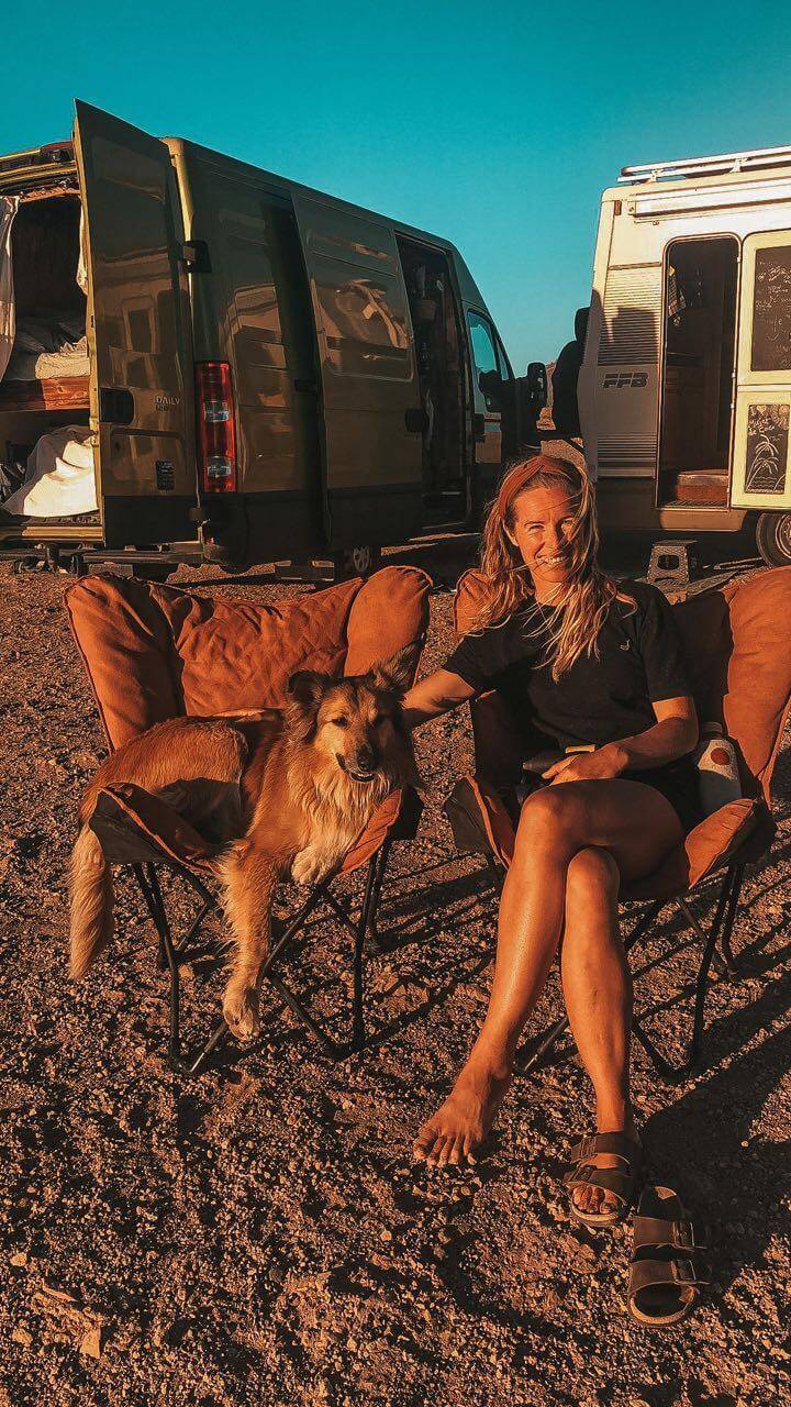
It was also my first adventure with Jonatan. He had come to say hi at my camper and never left. He already knew his way around a long trail. I did not. We set off south from the dunes near Corralejo. I learned as I went.

We wild camped every night. Behind stone walls. In dry barrancos. Once above a beach. The waves sent us to sleep. I refilled water in the villages. I carried enough to bridge the long dry stretches. The days were simple. Walk, refill, eat, find a flat spot before dark, sleep and start again. My favourite stretch was the mountains around Betancuria. There the trail climbs out of the plains and suddenly the whole island lies below you.
It was not all easy. Loose dogs went for Wingo near La Pared and he got hurt. We patched him up as best we could. But we could not keep walking with him like that. Our thru-hike ended in La Pared. I walked the southern coast on later trips back to the island. Piece by piece, out of the van. It is worth the effort. Walk down to El Puertito de Jandía for the most beautiful night skies. Then catch the bus back to Morro Jable.
Would I hike it again?
Yes. And I would do a few things differently. I would still walk north to south. I would still take my time around Betancuria. I would still carry a tent and sleep out. But I would plan the water more carefully. I would keep Wingo much closer around the farms. And I would check the wind before the longest exposed days.
Would I pick it as a first long hike? Yes. Fuerteventura is a gentle place to learn. You just need to be happy carrying a few litres of water. All the GR131 trails could be a nice first long hike. Not the easiest. But definitely doable. If you want to be well prepared, I put what I learned into Your First Hike.
What makes Fuerteventura special
A lot of people skip Fuerteventura. They think it's boring. Empty. A desert where nothing grows. But it's actually very, very cool.
I've spent a lot of time here by now. Three winters with my campervan. I sailed in and out. And I hiked across.
Most people only ever see the beach. They go from the airport to the hotel, the resort or the little town where they stay. But there's so much more to the island than that. Especially inland. There's more green out there than you expect. This year the island got more rain than it had seen in many years. Even many locals had never seen it this green.
In some spots the silence is total. Down in the barrancos. In the old volcanic land. And you can walk it in winter like the other GR131 trails. When the rest of Europe is cold and half asleep. Looking for another winter trail? The Waitukubuli National Trail in Dominica is one. It's on the other side of the Atlantic, in the Caribbean.
On Fuerteventura the official name is the GR 131 Camino Natural de Fuerteventura. In English that's the Fuerteventura Nature Trail. It crosses the island lengthwise. From the dunes of the north, past the old villages and the mountains around Betancuria. All the way down to the lighthouse at the end of the land.
Three ways to hike the GR131 Fuerteventura
Carrying everything
That's how I did it. You carry your food, water and tent. It gives you a lot of freedom. But you need to plan your water well. And check the current camping rules.
Village to village
You sleep in a bed every night and carry less. You do need to book ahead. Tefía, Betancuria and La Pared have very few beds. Book those first.
A few stages at a time
That's how I walked the south. You stay in one base and take the bus to and from the trail. Puerto del Rosario works for the north and the middle. Line 6 runs to Corralejo. Line 2 runs to Betancuria and Vega de Río Palmas. Morro Jable works for the south. Lines 1 and 10 run up the island from there.
Where to stay on the GR131 Fuerteventura night by night
This is the plan if you sleep in a bed every night. Night 1 is the night before you start walking. Each town has a link to compare places on your dates. The casas rurales out here often only take bookings by phone or WhatsApp. Their numbers are on Google Maps.
| Night | Sleep in | Beds | Good to know |
|---|---|---|---|
| 1 | Corralejo | Plenty | Book two nights if you add the Lobos day |
| 2 | La Oliva or Lajares | Some | Lajares is a few minutes off the trail |
| 3 | Tefía | Very few. Book first | Little food in the village. Carry enough |
| 4 | Betancuria | Few. Book first | Backup: Vega de Río Palmas |
| 5 | Pájara | A couple of hotels | Best resupply in the middle |
| 6 | La Pared | One hotel. Book first | Backup: Costa Calma by taxi |
| 7 | Costa Calma | Plenty | No beds at the end of the stage. Bus 5 to Morro Jable |
| 8 | Morro Jable | Plenty | Fills up in winter |
| 9 | Morro Jable | Plenty | Bus 111 back from the lighthouse twice a day |
Bus times change. Tiadhe is the island's bus company. Check their current timetable before you go.
The route, stage by stage: water, food and where to sleep

The official route has nine stages. One is on Lobos. The other eight are walking days from Corralejo to the lighthouse. I did not walk it with a measuring wheel. The distances below are the official figures. Online you'll see anything from 150 to 173 km. It depends on what gets counted. You climb around 2,700 metres in total. Almost all of it sits in the middle around Betancuria and Pájara.
| Day | From | To | Distance | What the day is like |
|---|---|---|---|---|
| 1 (optional) | Lobos harbour | Faro de Martiño | 8 km | Flat islet. Ferry over and back. No dogs ashore |
| 2 | Corralejo | La Oliva | 24 km | Long and flat through dune country, fully exposed |
| 3 | La Oliva | Tefía | 20 km | Open volcanic slopes past the sacred Montaña de Tindaya |
| 4 | Tefía | Betancuria | 17 km | The first real climb, over the Guise y Ayose pass |
| 5 | Betancuria | Pájara | 16 km | Short but up and down all day through the mountains |
| 6 | Pájara | La Pared | 25 km | The hardest day. Remote and windy, nothing in between |
| 7 | La Pared | Risco del Paso | 18 km | Down to the sand and the wild west coast |
| 8 | Risco del Paso | Morro Jable | 16 km | Easy coastal walking through deep sand |
| 9 | Morro Jable | Punta de Jandía | 14 km | Remote arid coast out to the lighthouse |
Day 1: Isla de Lobos, the optional start I skipped (around 8 km)
The official trail starts on Lobos. That's the little islet off Corralejo. You take the ferry over, walk a flat loop out to the lighthouse at Faro de Martiño and take the ferry back. It's easy walking on a protected islet. You can't stay overnight. You need a free permit and a time slot. The kiosk by the harbour is seasonal. Bring your own water.
I skipped it this time. Dogs are not allowed to land on Lobos. And I had already been. I've sailed in a couple of times over the years and love it. There's a tiny village with a little bar. The walking is easy and pretty. Hiking without a dog? Then it makes a lovely half-day before you set off. Catch the first boat and you're back in Corralejo by lunch. Doing Lobos? Then book two nights in Corralejo.
Day 2: Corralejo to La Oliva (around 24 km)
This day is long, flat and wide open. Here you learn that easy on Fuerteventura can still mean six hours in full sun and wind. You head out of Corralejo through the dune country. Big skies and old windmills. The first marker is tricky to find. Look near the Shell station square. You pass Lajares, with a café and a small shop a few minutes off route. Then Villaverde. Both are good places to top up and eat something warm. Before La Oliva you cross the Malpaís de la Arena. It's an old lava field, almost completely covered in lichen. La Oliva at the end has beds. So does Lajares. Don't leave Corralejo without enough water for a long open day.
Day 3: La Oliva to Tefía (around 20 km)
The day runs over gentle volcanic slopes. Open and exposed. You skirt Montaña de Tindaya, the sacred mountain. The Guanche held it holy and it still feels that way. Tindaya village comes early, with a café, a cheese shop and a mini-market. Fill up there. Tefía is small. There's an agricultural museum and not much food. Carry enough for the night. Beds are very few in Tefía. Book the one rural hotel first.
Day 4: Tefía to Betancuria (around 17 km)
This was my favourite day. First you pass Llanos de la Concepción and Valle de Santa Inés. Both have a bar where you can fill up. Then you leave the plains. You climb into the Betancuria massif, the oldest corner of the island. Up over the Guise y Ayose pass. Two Guanche kings cast in bronze look out over all of it. These are real mountains. Greener in winter, and quiet. Betancuria was the island's first capital. It was founded in 1404. Now it's a few white houses, a church, a couple of places to eat and a few beds. There's no grocer. Eat and refill here. Leave Tefía with enough water. The first bar is in Llanos de la Concepción. Betancuria full? Vega de Río Palmas is the next village along the trail. It has a few rural houses.
Day 5: Betancuria to Pájara (around 16 km)
It's up and down all day. The trail follows the dry bed of the Río Palma. It passes Vega de Río Palma and Toto. It's a short stage. But it keeps climbing and dropping. Pájara has a Spar, bars and a couple of hotels. It's the best resupply in the middle of the island. Stock up here for what's coming.
Day 6: Pájara to La Pared (around 25 km)
This is the long empty one. You cross the central range to the west coast. It's the most remote stretch of the whole trail. There's nothing in between. No village, no tap, no bar. And wind the whole way. This is the day to respect most. La Pared at the end has one hotel, one bar and a small shop with a bit of fresh food. It's the last proper bed before the south. Carry your maximum water out of Pájara. Check the wind before you set off. La Pared full? Costa Calma is a short taxi ride away.
Day 7: La Pared to Risco del Paso (around 18 km)
You drop down to the sandy isthmus. Here the island almost pinches in two. The wild west coast takes over. The El Jable sand desert starts around here. It's soft underfoot. The waymarking goes thin across the dunes. Keep your GPX open. There are no beds at the end of this stage. Costa Calma and Esquinzo sit just over on the east side. They have supermarkets and beach bars. Most people sleep in Costa Calma. Bus 5 runs between Costa Calma and Morro Jable.
Day 8: Risco del Paso to Morro Jable (around 16 km)
This is the easy coastal day. Beach and low cliff, with the Atlantic on your right the whole way. There's deep sand in places. Beach bars come towards the end. Morro Jable is the big town of the south. It has everything you need: hotels and apartments, shops and the ferry port. Book ahead, because it fills up in winter. Stock up here for the final day.

Day 9: Morro Jable to Punta de Jandía (around 14 km)
This is the finish. A remote arid coast out to the Faro de Punta de Jandía lighthouse on the island's south-west tip. The mountain wall of Jandía is on your right. It's exposed and there's barely a soul. Nothing until the end but the tiny hamlet of El Puertito de Jandía, with a couple of seasonal fish restaurants. Carry water out of Morro Jable. And then you reach the lighthouse. Nothing behind it but the Atlantic. The end of the land. There are no beds out here. Bus 111 runs back to Morro Jable twice a day. You can't reserve a seat. Check the times or budget for a taxi. Then sleep in Morro Jable again.
A wilder add-on in the south: Cofete
Have the legs and the nerve for it? Then the Cofete valley on the Jandía peninsula is one of the wildest places on the island. A huge empty beach under a wall of mountains, far from anything. You can walk over to Cofete and back. Or walk over and take bus 111 back. It's not an easy path. And not one for you if you suffer from vertigo. But the scale of it is something else. You can line up more routes on the island with AllTrails for Fuerteventura.
Water and food
You carry your water on this trail. You refill in the villages. There is almost nothing reliable in between the towns. On one stretch we did find a stream with enough water for a swim. I'll let you discover where. But you can't plan your days around a surprise like that. Treat the island as dry and carry what you need.
I drank from village taps and bought bottles in the shops. I topped up every chance I got. On a normal day I carried three litres. On the long exposed stages like Pájara to La Pared I carried more. Plus extra for Wingo. Reckon on two and a half to four litres per person per day. A collapsible bottle weighs nothing and buys you peace of mind. I carry a Katadyn BeFree filter on every trail. On this island the water came from taps and shops. So you won't lean on it much here. Bring it anyway for the one stream you might find.
Food runs to the same rhythm. Small supermarkets and village bars, then stretches of nothing. I carried a couple of days of trail food. I topped up where the island let me. Pájara has the best resupply in the middle. A warm goat cheese bocadillo in a village bar after a long dusty morning? One of the finer meals of my hiking life.
Navigation and GPX
The trail is well waymarked with the red and white GR stripes. It's fairly easy to navigate. Sometimes the times and distances on the signs didn't match each other. Or what my navigation app said. A few spots still catch people out. The marking goes thin in the lava fields (the malpaís). And across the El Jable dunes in the south. There a dozen farm tracks look exactly like the trail. The very start in Corralejo is badly signed too. Look for the first marker near the Shell station square.
So carry a GPX. Don't lean on the blazes alone. This is what I actually use. My main one is the GPX track in Mapy with offline maps. My backups are AllTrails and Gaia GPS. For emergencies I carry a Garmin inReach Mini. Download your offline maps before you set off. Phone coverage is patchy in the interior and the south.
Wild camping
I wild camped every night when I walked the GR131 in 2022. That does not mean wild camping is legal now. The rules for camping in the Canary Islands change. So do the protected areas and the designated camping zones. Check the current rules before you go. Don't use my 2022 experience as permission.

The simplest option is to hike town to town and book a bed. Sleeping outside? Stay well away from the protected zones. That's the Corralejo dunes, the Jandía natural park and Isla de Lobos. Make no fire. Leave nothing behind. Follow the current local rules. I loved sleeping outside on this trail. I just keep what I did separate from what is officially allowed. More on the island's camping and vanlife rules is in my Fuerteventura travel guide. How I think about sleeping out is in my wild camping stories from the GR11.
Hiking the GR131 with a dog: what happened to Wingo
Can you hike the GR131 with a dog? Mostly yes. I wouldn't call it carefree. Wingo walked the trail with me and loved most of it. In winter the island suits a trail dog. Open land, cool temperatures and few restrictions outside the protected zones.
What worked for us was simple. The winter temperatures kept him comfortable. The open terrain gave him room. I planned water for two. And I checked his paws every evening on the hard stony ground.
What went wrong was the farm dogs. Near La Pared, loose dogs went for Wingo. He got hurt. That is where our thru-hike ended. Plenty of properties out here keep loose dogs that defend their patch. The real hazard on this trail is the dogs at the farms.
There are things I'd do differently now. After La Pared I stopped treating open landscape as safe for a dog. Now I bring Wingo in close before we reach a property. I don't wait until a dog is already running at us. I carry a first-aid kit that covers paws and bites. And I bring enough water for two. You may like reading my full pack list for thru-hiking with a dog.
Getting there and home
Fly into Fuerteventura airport at Puerto del Rosario in the middle of the island. Then take a taxi or the bus (line 3 to the station, then line 6 to Corralejo). Better still, come by sea. The ferry from Playa Blanca on Lanzarote lands right in Corralejo. It takes about half an hour. Walked Lanzarote first? Then that same ferry drops you at the trail's start. Corralejo is a good place to stock up and spend the night before you walk. Want to reach the islands without flying at all? I wrote a whole guide on how to travel to the Canary Islands without flying.
Morro Jable at the south end has buses back up the island. It also has the ferry on to Gran Canaria. That ferry is how the GR131 carries on to the next island. There the trail runs between Maspalomas and Agaete. Walk it from Maspalomas up to Agaete. From Agaete the ferry crosses straight to Tenerife. Finishing at the Fuerteventura lighthouse? Bus 111 back runs only about twice a day. Check the times or plan for a taxi. For the optional Lobos day, boats leave Corralejo harbour roughly every half hour. The crossing takes about fifteen minutes. You need a free permit and a time slot. Dogs are not allowed to land.
What I would pack
My pack for Fuerteventura
This is kit chosen for this island. On my first crossing I walked with borrowed and secondhand gear. A borrowed backpack, an old sleeping bag and my running shoes. It did the job. You don't need perfect kit to start. Here is what I would carry now.
- Water capacity for three litres and more. Plus extra for the dog. You plan the whole trail around this.
- A free-standing tent that handles wind. You pitch on hard stony ground here. Pegs alone won't hold.
- A warm layer for the nights. They get colder than the daytime suggests. Even in winter.
- Trail shoes. They are enough for almost all of it. I walked my first crossing in running shoes.
- Sun cover. A hat, long sleeves and a sunscreen that does not poison the ocean. There is no shade out here.
- Offline maps and the GPX on your phone.
- A Garmin inReach Mini for the empty stretches. Phone signal is decent on most of the island but not everywhere.
- For a dog: extra water, daily paw checks and a first-aid kit that covers paws and bites.
I walk with the Osprey Eja these days. My full gram-by-gram list is in my pack list post. Dog gear included. Packing for your first long hike? There's more on that in Your First Hike.
Eight things I wish I had known
- The kilometres are not the hard part. The exposure is.
- Wind can ruin an otherwise easy day. Check the forecast too.
- Water is the real itinerary. Plan your days around the refills.
- A village on the map does not mean an open shop. Carry a buffer.
- The trail markings are not enough everywhere. Keep your GPX open in the lava fields and the dunes.
- Farms mean dogs. Bring your own dog in close before you reach a property.
- The nights can feel surprisingly cold after a hot day. Pack a proper warm layer.
- Do not rush Betancuria. It was the best part of the walk for me.
Which GR131 island should you walk?
I've walked three of them. Each is a different trail. Fuerteventura gives you space and quiet. Gran Canaria has the drama and the mountains. Tenerife has the volcano and the big climbs. Want the busier, steeper, greener islands? Read my guides to the GR131 on Gran Canaria and the GR131 on Tenerife. Walking with a dog? Then skip Tenerife for now. Dogs are no longer allowed in Teide National Park. For space and quiet, Fuerteventura is the one.
FAQ
How long is the GR131 Fuerteventura?
The GR131 across Fuerteventura is about 150 km long. It runs from Corralejo to the lighthouse at Punta de Jandía. You climb around 2,700 metres in total. Most of it is in the middle around Betancuria and Pájara.
How many days do you need?
The full route is eight walking days, plus the optional day on Lobos. I took it slow with a tent and a dog. It took us about a week to reach La Pared. That's where we had to stop. Strong hikers staying in hotels walk it faster.
Is the GR131 Fuerteventura hard?
Technically no. The paths are good and the waymarks are clear. The climbs are moderate. The Betancuria section is the hilliest part. What makes it demanding is the exposure. Sun, wind and long dry stretches with no shade and no water. You plan it around refills.
Can you wild camp on the trail?
Not officially. Free camping outside designated areas is not permitted on Fuerteventura. The rules are tightening. I wild camped in 2022. Please don't treat that as permission. Stay out of the protected zones and leave no trace. Check the current rules with the Cabildo de Fuerteventura. The simplest legal option is to hike town to town and book a bed.
Can you hike it with a dog?
Yes. My dog Wingo walked the trail with me until La Pared. The ground is hard and stony on paws. Carry water for two. Be careful around farms. Loose farm dogs are the one real hazard. Wingo got injured by them on this trail. Leash up near properties and keep moving.
How much water should I carry?
There is almost no reliable water on the trail. You refill in the villages. Carry enough to bridge the gaps. Reckon on two and a half to four litres per person per day. Take more on the long exposed stages like Pájara to La Pared. And extra again if you walk with a dog.
Where does the GR131 Fuerteventura start and end?
The official trail starts on Isla de Lobos, the little islet off Corralejo. Most people start in Corralejo itself. It ends at the Faro de Punta de Jandía lighthouse on the island's south-west tip. I walked it north to south. I would do it that way again.
When is the best time to hike the GR131 Fuerteventura?
October to April. I walked it in winter. That's when the rest of Europe is cold and half asleep. In summer the heat and the lack of shade make the long exposed days hard.
Can you walk only some stages?
Yes. Buses connect most of the towns on the route. I walked the southern coast piece by piece on later trips. Out of the van.
Is the GR131 Fuerteventura well marked?
Mostly yes. It has the red and white GR stripes the whole way. The marking goes thin in the malpaís lava fields and across the El Jable dunes. The distances on the signs are often wrong too. Carry a GPX track on your phone.
Do you need a permit or a guide?
No. You can walk the GR131 Fuerteventura on your own without a permit. Only Isla de Lobos needs a free permit and a time slot. We walked it without a guide. Just with a GPX track on the phone.
Final thoughts
A week of slow walking. Wild camps behind stone walls. A dog asleep by the tent.
The GR131 Fuerteventura won't shout at you the way famous trails do. There are no giant summits. No dramatic alpine passes. What there is: wind and space and dust. Little white villages, goats and long empty tracks. And the Atlantic turning up when you least expect it. If you slow down enough, there is something really beautiful in that.
This was my first long-distance trail. I ended up loving it. It made such good memories. And it gave me a new hobby.
Planning your first multi-day hike? I put everything I wish I had known before my first long trail into Your First Hike.
Stay wild.
With love, Suzanne
Explore more
Read next

Watch on YouTube


Wild at heart? Let's be friends.
Join me on YouTube for slow travel adventures by van, sail and on foot.
Or get my new stories by email, every couple of weeks.
Ocean Nomads is the community I founded, for people who want to live a little wilder, explore a little further, and do it with good people.
For deeper trail stories and the behind-the-scenes, I write on Patreon.
Some links are affiliate links. At no extra cost to you, they give me a tiny piece of the pie. That raises the adventure fund and helps me keep exploring and creating. I only recommend things I truly love and use myself. Huge thanks if you buy through this website (but try to find it second-hand or locally first!).