

Updated May 2026.
An 85 km trail across the island of Gran Canaria in the Canary Islands.
Table of Contents
- GR131 Gran Canaria: stages at a glance
- What is the GR131 Gran Canaria?
- Why hike the GR131 Gran Canaria
- How we hiked the GR131 in Gran Canaria
- Video: GR131 Gran Canaria, day 1
- Which direction should you hike?
- Navigation on the GR131 Gran Canaria
- Best time to hike GR131 Gran Canaria
- Water and food on trail
- Weather on the GR131
- What to pack for hiking the GR131
- Camping in Gran Canaria: wild camping and campgrounds on the GR131
- A route that works (with accommodation)
- Recommended links and resources
- FAQ: GR131 Gran Canaria
- What makes this trail special
- Final thoughts
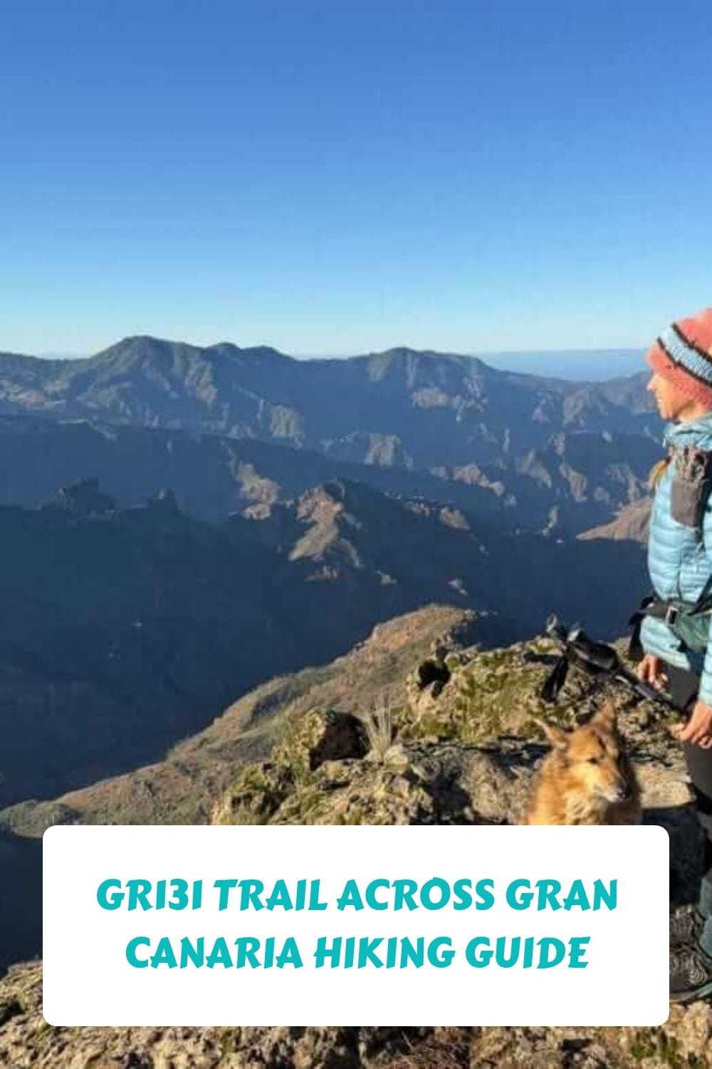
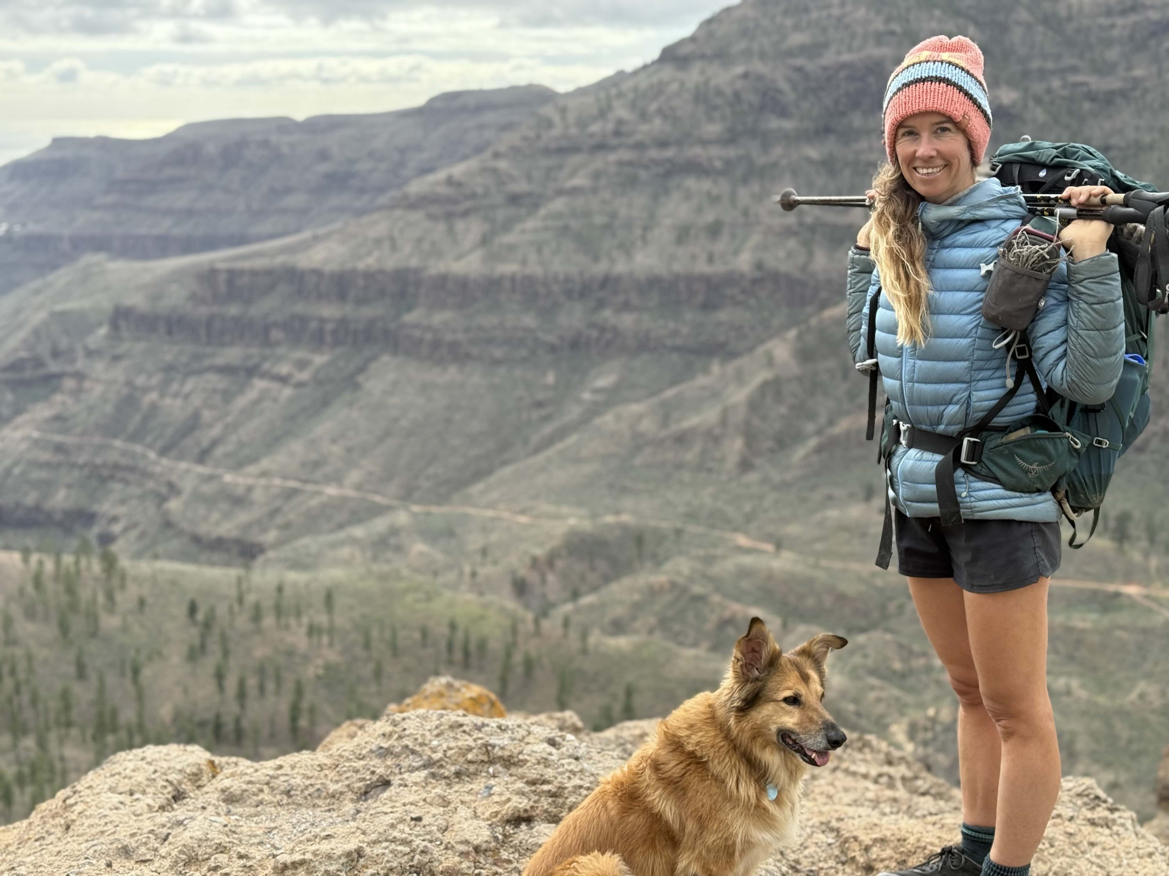
This winter I hiked 85 km on the GR131 in Gran Canaria. Together with my dog Wingo and partner Jonatan. What a beautiful trail. The route goes across the island through all sorts of ecosystems and vegetation, ocean breeze, local villages, and wild Atlantic Ocean views. From green to dry. From mountains to desert. From one ocean to another.
This guide is to help you get ready for hiking the GR131 yourself. I share daily vlogs about the trail on my YouTube channel too.
Can't find the answer in this guide? Drop a comment.
And let's connect, I share more tips and tales on YouTube and Instagram.
The GR131 Gran Canaria in a nutshell
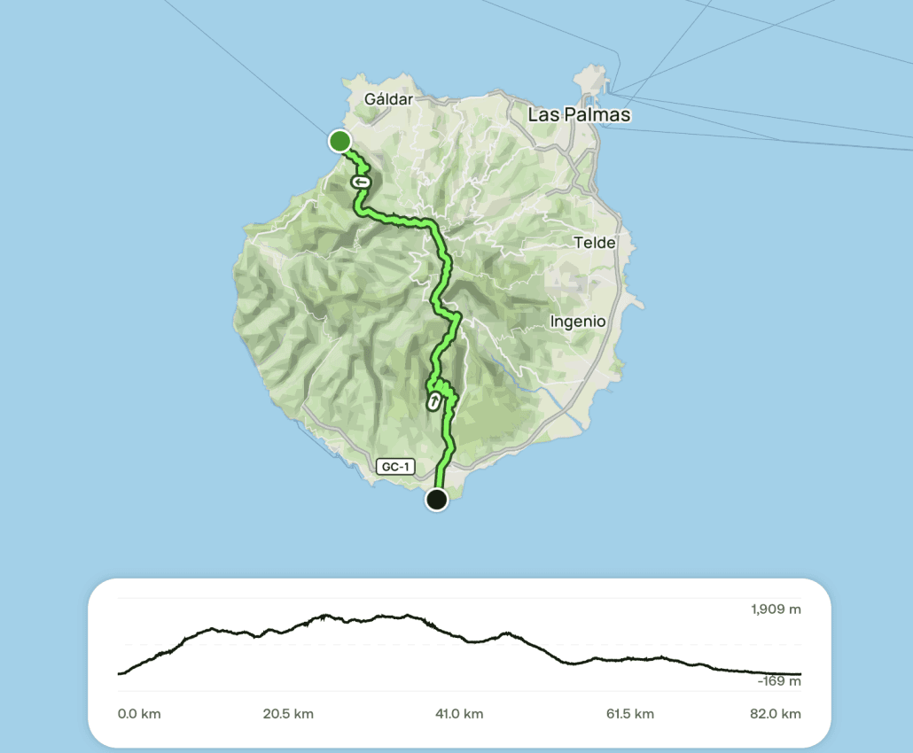
- Distance: around 85 to 95 km depending on your route (some variations exist)
- Duration: 3 to 6 days. Two for the very fast.
- Start: Agaete (north coast) or Maspalomas (south coast)
- Finish: Maspalomas (south coast) or Agaete
- Difficulty: Moderate to challenging, especially the first climb
- Accommodation: villages, rural stays, caves, or wild camping along the trail
- Navigation: mostly marked, GPX recommended
- Best time to hike: November to May
- Dog friendly: Yes
GPX track and map
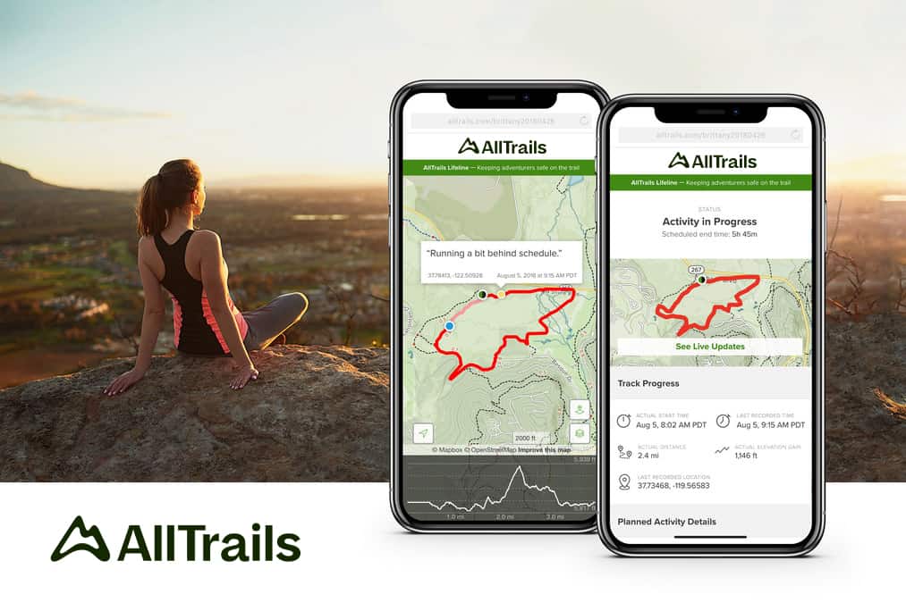
Download the GR131 route as a Wikiloc GPX track (Maspalomas to Agaete) for offline navigation, or open the Camino de Santiago de Gran Canaria route on AllTrails to see the full map and elevation profile. I navigate with Mapy (load the GPX into it for offline use).
Hi, I'm Suzanne. Having hiked 11 long-distance trails totalling over 2,000 km on foot, I'm an avid hiker, and I'm here to help you get prepared for trail life, a simple, healthy and natural way of travel and being with nature.
I already knew Gran Canaria from sailing in and out many times around Atlantic crossings, and I was wondering how excited I would actually be to hike it. Walking across Gran Canaria felt like a thing I had to do, and it surprised me. I thought Gran Canaria was a busy island, and in some parts it is. But once you walk away from the crowds you'll find pure and wild nature, and in some parts even no civilization at all.
Below: how we hiked it, the practical logistics, the towns on trail, and how to make it work without complications.
GR131 Gran Canaria: stages at a glance
| Stage | From | To | Distance | Difficulty |
|---|---|---|---|---|
| 1 | Agaete | Artenara | ~20 km | Hard (big climb) |
| 2 | Artenara | Cruz de Tejeda / Tejeda | ~12 km | Moderate |
| 3 | Cruz de Tejeda | San Bartolomé / Tunte | ~18-20 km | Moderate |
| 4 | San Bartolomé | Ayagaures | ~10-12 km | Easy |
| 5 | Ayagaures | Maspalomas | ~13 km | Moderate (hot, exposed) |
Total: around 85 km. Detailed stage-by-stage notes with accommodation further down.
Here's a 3-minute summary of our hike across the GR131 Gran Canaria:
What is the GR131 Gran Canaria?
The GR131 in Gran Canaria is part of the larger GR131 that crosses seven of the Canary Islands: Lanzarote, Fuerteventura, Gran Canaria, Tenerife, La Gomera, La Palma and El Hierro.
On Gran Canaria, the trail roughly connects the north-west coast with the south coast. Most commonly between Agaete and Maspalomas. It's also called the Camino Natural de Gran Canaria, and along the way you'll notice that parts of the route overlap with older camino routes.
In places like Tejeda and San Bartolomé de Tirajana, there are even references to the Camino de Santiago de Gran Canaria. Recently some variations of the trail have been made with an option to hike to or from the airport. The “old” route, from Agaete to Maspalomas (or vice versa), is more spectacular. In both the south and the north, the scenery is something else.
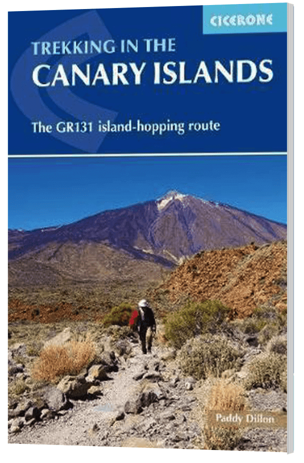
Officially the GR131 of Gran Canaria are stages 15-19 of the larger GR131 Trail (as per the Cicerone Guidebook).
Here we are hiking uphill out of Agaete. Good to be on trail again.
Why hike the GR131 Gran Canaria
We chose this island hike because it starts on our doorstep from the campervan, our home base this winter in the Canaries. It's an easy trail to hike with our dog Wingo, and given the latitude, it's nice to hike in winter. We've already hiked across Fuerteventura and Tenerife on the GR131 (both highly recommended). Time to explore Gran Canaria.
The GR131 gives you a lot of variety for such a short trail. You move through:
- Shaded forest
- Flower-rich meadows (in spring)
- Spectacular canyons
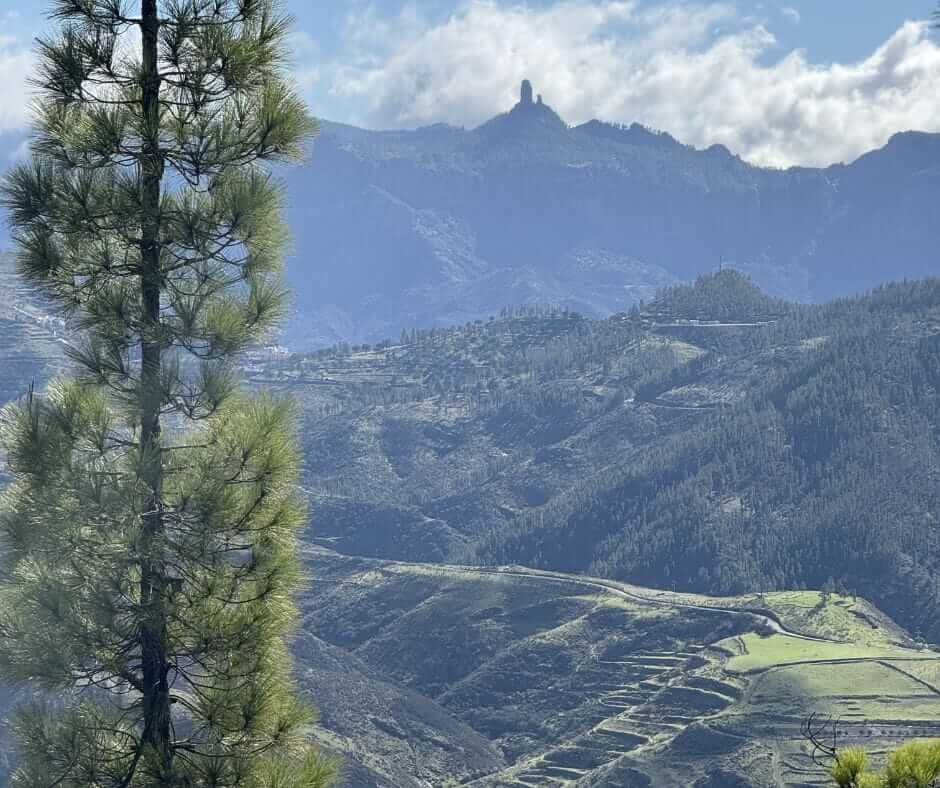
- Tamadaba Nature Park
- Quiet towns with cafés
- Ridges overlooking the islands
- Multiple ecosystems in one trail
The navigation is simple, the distances are reasonable, and you can resupply in a couple of towns along the way. The exposure near the highest point makes the trail feel wild without the technical challenges of alpine terrain.
It's a great training trail or a good option if you only have a few days and want something memorable that's logistically easy. I'd also recommend this trail if you're new to multi-day hiking and want to test the waters before doing a bigger one. And I'd definitely hike this trail (or the GR131 across Tenerife) before sailing across the Atlantic, you'll start the crossing with little movement and a good baseline of fitness.
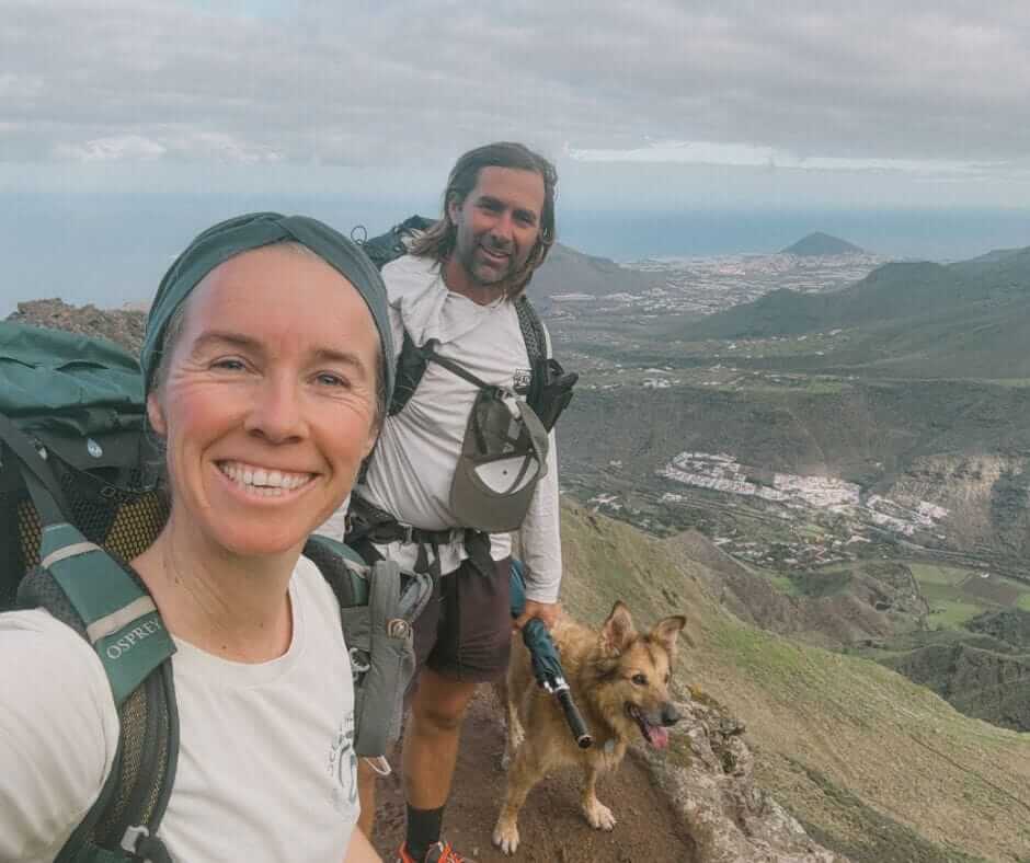
How we hiked the GR131 in Gran Canaria
It was me, my partner Jonatan, and our dog Wingo. We began at Agaete in the north-west, where we'd parked the campervan. Down by the bay we found the first red and white GR trail marker. The first 10 km are a steep ascent and very beautiful. We hiked from Agaete to Tamadaba to Artenara to Cruz de Tejeda to Tunte to Ayagaures to Maspalomas (keep reading for the best trick for the last bit).
The trail has variations, so it wasn't just blindly following the red and white stripes. Each crossing has a surprising amount of trail signs. If you're after the same route I took, which is the original, you have to stay alert.
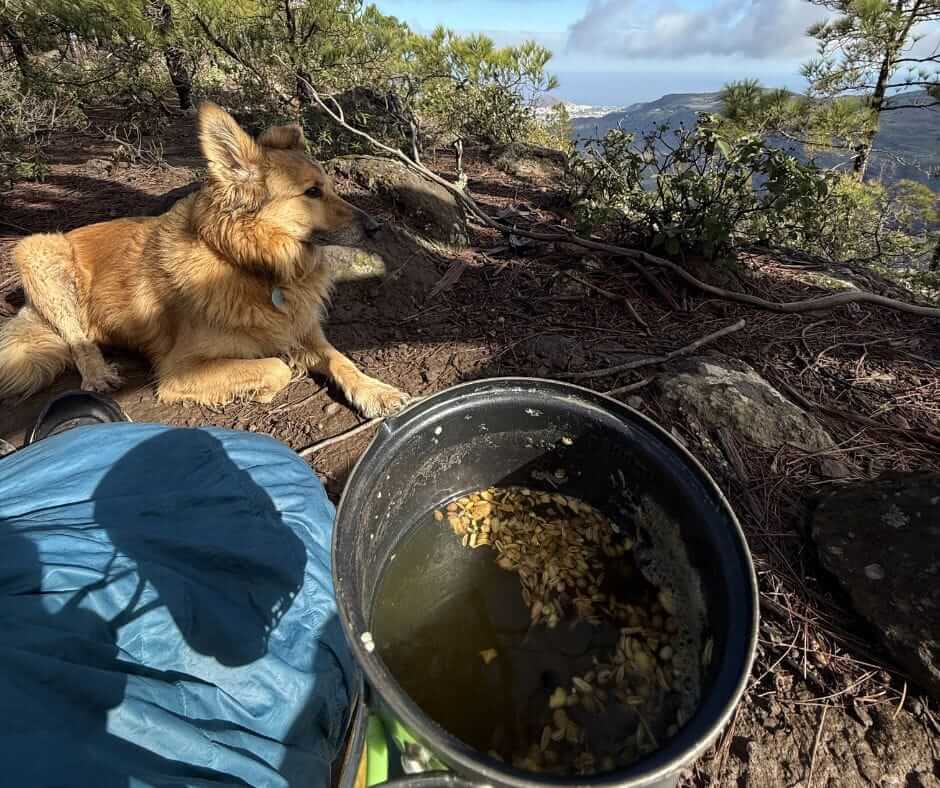
There are 5 official stages. We did roughly a stage a day, which is doable. If you're a fast hiker you can combine stages, we even met a trail runner who was doing the whole thing in 1 day. We hiked with our dog so we took lots of breaks. We didn't want this trail to end.
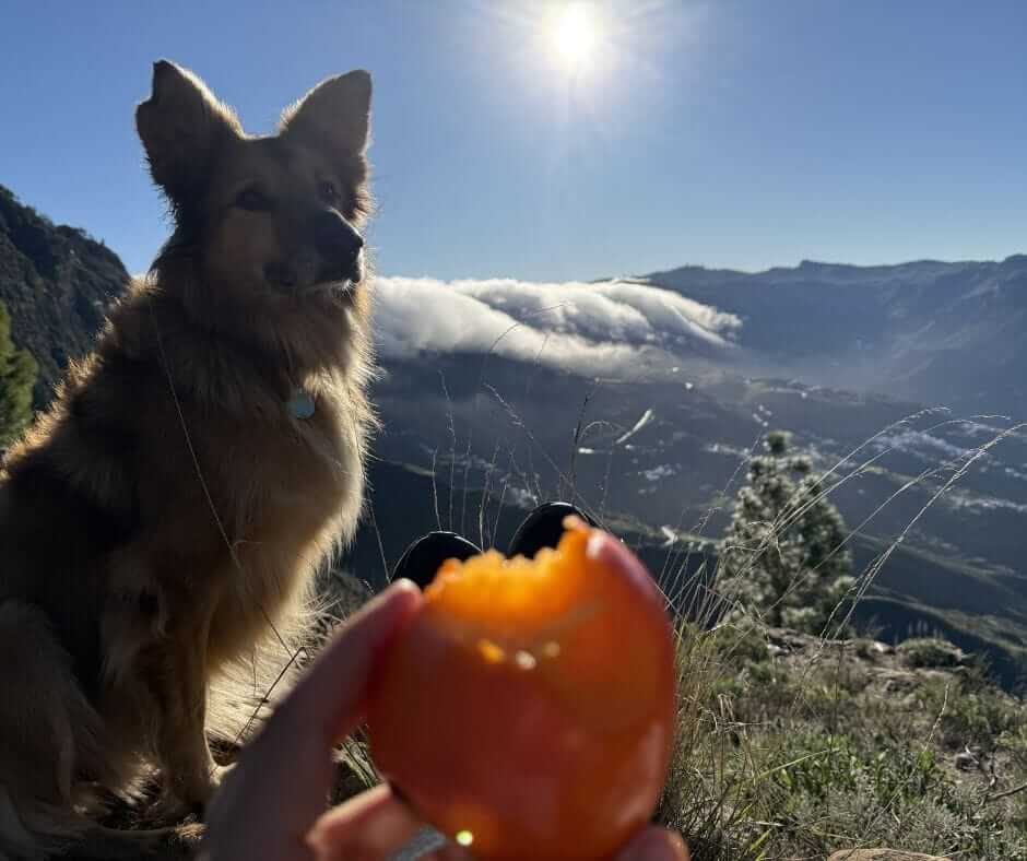
We hiked in late December. Perfect hiking weather. Some rain to start, which gave us epic waterfalls and lots of drinking water for us and the dog, so the rain turned out to be a blessing. Higher up around Cruz de Tejeda it was cold, but only briefly.
We carried a tent because we hiked with Wingo. This gave us flexibility to wing it. Accommodation along the route exists if you prefer not to camp, but spots are often booked out in advance and the costs add up. I share my accommodation suggestions further down.
After finishing in Maspalomas an Ocean Nomads friend was around and picked us up with his van to drive back to ours. If you're without a dog you can simply take the bus. What a contrast with the trail, that highway.
Video: GR131 Gran Canaria, day 1
Day 1 of hiking the GR131. We decide to just go for it, pack the picnic, and set out. I talk through how we prepare, my favourite herbs and spices to bring, and some thoughts as we head out.
Day 2, Tamadaba to Artenara. I stayed quiet and let the views and the scenery do the magic.
Which direction should you hike?
You can walk the GR131 in both directions. Some people start in Agaete and walk south to Maspalomas. Others do the opposite. Both work.
If you start in the north, you go straight into a big climb and into the forests of Tamadaba, then finish in the dry south of the island.
If you start in the south, the hike builds more gradually and becomes greener and wilder as you move north.
In the end, it often comes down to practical things like accommodation availability, weather, and whether you're doing this trail as part of more GR131 trails (which I can highly recommend). There's a ferry leaving for Tenerife from Agaete, very practical if you're continuing on. I really liked Agaete. In Maspalomas you probably want to stay as little time as possible, it's a busy and popular sun-sea-sand holiday spot.
Navigation on the GR131 Gran Canaria
The trail is mostly marked with red and white GR signs, but not always consistently. In some sections, especially in the mountains and on descents, it's easy to miss turns. There are also variations made in some parts so you need to follow different signs depending on which version you're walking. We followed Camino de Santiago de Gran Canaria, except for the last bit Ayagaures to Maspalomas where we found a much wilder option.
I used Mapy and AllTrails for reference. See Camino de Santiago de Gran Canaria on AllTrails for the route visualised.
You can also download a GPX track (this one is from Maspalomas to Agaete) and upload it to Mapy or another navigation app.
Best time to hike GR131 Gran Canaria
Gran Canaria, and all the Canary Islands, is one of the (if not THE) best places in Europe for a winter hike. From November to May the conditions are great, with each month offering something different. Because the trail crosses many ecosystems, weather-wise you'll likely get a bit of everything.
- November: warm, quiet, great start of the season
- December: ideal mix of sun and fresh air, cooler higher up
- January: cool mornings, clear days, very good hiking conditions
- February: stable weather, fewer crowds, great visibility
- March: warmer, longer days, spring arriving
- April: warm and long days
- May: getting hotter, more flowers
We hiked at the end of December and it was perfect. Sometimes I had to put all my layers on, but mostly it was shirt and shorts. I hiked across Tenerife in May, which was spectacular with the flowers. I've spent numerous winters in the Canaries from October to June and each month would work for hiking.
If you can be spontaneous, it's really cool to hike this trail after rain. We had spectacular waterfalls and lots of water, which made drinking easy.
In summer, especially in the south, it gets very hot. Avoid July and August.
Water and food on trail
It's usually a dry area. Water is normally limited on-trail (though not when we hiked it). You can refill in each village, mostly at bars, restaurants and accommodations. Sometimes there are water points and streams in the wild. We were lucky, especially with the dog, with all the streams after the rain. Maps.me shows some of them. Always use a water filter.
I recommend Maunawai (better but heavier) or Katadyn BeFree (ultralight and often good enough).
Tap water is often chlorinated. Each village has food options but be mindful about opening hours.
Opening hours on trail
Shops and cafés on trail often have limited hours. Anticipate this so you can eat and resupply:
- Open around 10am
- Close early afternoon
- Closed on Mondays
- Long siesta breaks
Weather on the GR131
Being in the middle of the Atlantic, the temperatures are good year-round. I've hiked on the GR131 in the Canaries in December, January, February, March, April and May. All amazing.
- May: flowers, long days, mild temperatures
- Cruz de Tejeda: cold and exposed
- Wind: common and helpful
- Summer: avoid if possible (very hot, no shade)
- Winter: can be cold on some ridges
We hiked the GR131 across Gran Canaria in late December. The stages between Agaete and Cruz de Tejeda can be cold (great for hiking, in my experience). From Cruz de Tejeda to the south it was much warmer, sometimes hot.
Day 3 of our hike, between Artenara and Tunte:
What to pack for hiking the GR131
Keep it simple. I've seen some giant backpacks traversing through the trails here, which makes the hike way tougher than it needs to be. You really don't need much. Make sure to bring:
- Water filter (I recommend Maunawai or Katadyn BeFree)
- Sun protection (here's a DIY natural sunscreen recipe)
- Cap or hat, plus a beanie (Cruz de Tejeda is cold)
- Offline maps (I use Maps.me and AllTrails)
- Warm, wind- and waterproof layer (puffy + wind/rain jacket)
- Swimwear (or just use your underwear like I did and save some grams)
- One hiking outfit and one sleeping outfit
- Hiking shoes with good grip for sandy and rocky paths (I'm a fan of Topo's)
My all-time hiking and camping favourites

Gear that lasts:
- Backpack: Osprey Eja (48L) for women (here's a review) or Osprey Exos (58L) for men
- Patagonia 3L wind/waterproof jacket
- Icebreaker Merino Wool Legging and Crew Shirt
- Thermarest NeoAir Xlite Sleeping Pad
- Big Agnes tents: Fly Creek UL for solo + dog, Copper Spur for two people + dog
- Garmin inReach Satellite Tracker (not really needed for this trail)
- Sea2Summit UL Pillow (luxury item)
- Topo Athletic Trail Running Shoes (2-3 sizes too big)
Feet hack: Bring some wool. If you get a hot spot or sore foot, stuff a little bit of wool on the spot. The pressure point changes and your feet recover quickly. No need to buy the expensive branded “hikers' wool” from the outdoor store, any piece of wool will do.
Inspiration
If you want a deeper dive into my own long-distance hiking essentials, check out the video below or download my full gear list. Since I hiked across the Pyrenees (GR11) and had to traverse some serious mountains I finally really learned what is essential and what's not. Here you can download my packing list (including camping gear):
I also made a video showing what I carry on a multi-day hike. I carried the same setup on the GR131, only changed the shoes.
Camping in Gran Canaria: wild camping and campgrounds on the GR131
Camping in Gran Canaria is regulated. You're expected to use designated campsites, which usually require a free permit from the Cabildo. You can find all campgrounds and reservation info here.
Campgrounds on or near the GR131:
- Tamadaba: the only campground directly on trail, between Agaete and Artenara. Free with permit, pine forest setting.
- Morro de Santiago: close to the trail near San Bartolomé / Tunte, but not exactly on it. Worth a short detour if you want a legal camp night around stage 3.
What about wild camping? Wild camping in Gran Canaria is officially not allowed.
You might come across a 1993 regulation (Orden de 31 de agosto de 1993) mentioning temporary shelter for people travelling on foot. This is sometimes interpreted as allowing a short bivouac.
In reality it's not a free pass to camp anywhere. Permission is still required, and the rule was never meant for recreational wild camping. On the GR131 this creates a grey zone.
Most hikers combine options: campsites when they fit the route, accommodation in villages, and occasionally a discreet bivouac when needed.
We came across a really cool cave on trail which I would have loved to sleep in if it had been bedtime. I show it in this video and I've marked it on the Ocean Nomads member map.
Leave no trace when camping
If you spend a night outside, keep your impact as close to zero as possible:
- Camp on durable ground, not fragile vegetation
- Keep your spot small and discreet
- Take all your waste with you, including toilet paper (or use a portable bidet)
- Go to the toilet at least 60 meters away from water sources and trails
- Don't wash directly in streams or natural water
- Avoid noise and respect the silence of the place
- Never light fires, especially in dry areas like Gran Canaria
The idea is simple. If someone walks past the next morning, they shouldn't be able to tell you were there. You're responsible for your own choices.
You may like reading: Hygiene and Leave No Trace on Trail.

A route that works (with accommodation)
One of the biggest reasons people hesitate to hike the GR131 in Gran Canaria is logistics. Campsites require permits. Wild camping isn't officially allowed. Some stages don't seem to connect easily. So here's a version that works in reality. You walk across the island, stay in towns on the trail, and don't need buses. It can be done.
Where to stay on the GR131 in Gran Canaria with accommodation?
You can hike this trail so it ends each day in a place where you can find accommodation. Along the route you'll find hostels, guesthouses, small hotels and some campgrounds. There are some budget hostels but not many. You'll have more accommodation options if you're hiking with a buddy or your budget isn't tight.
See below for accommodations and campsite recommendations. Booking.com often allows last-minute cancellation, which is convenient when hiking with all the variables.
Learn how to get 10-20% off bookings on Booking.com when booking multiple hostels or hotels at once.
This is close to how we hiked the GR131 from Agaete to Maspalomas, and how you can hike it without a tent.
Stage 1: Agaete to Artenara (~20 km)
You start in Puerto de las Nieves, just outside Agaete. After walking through town you start climbing. Properly. Leave early, you have a big uphill ahead.
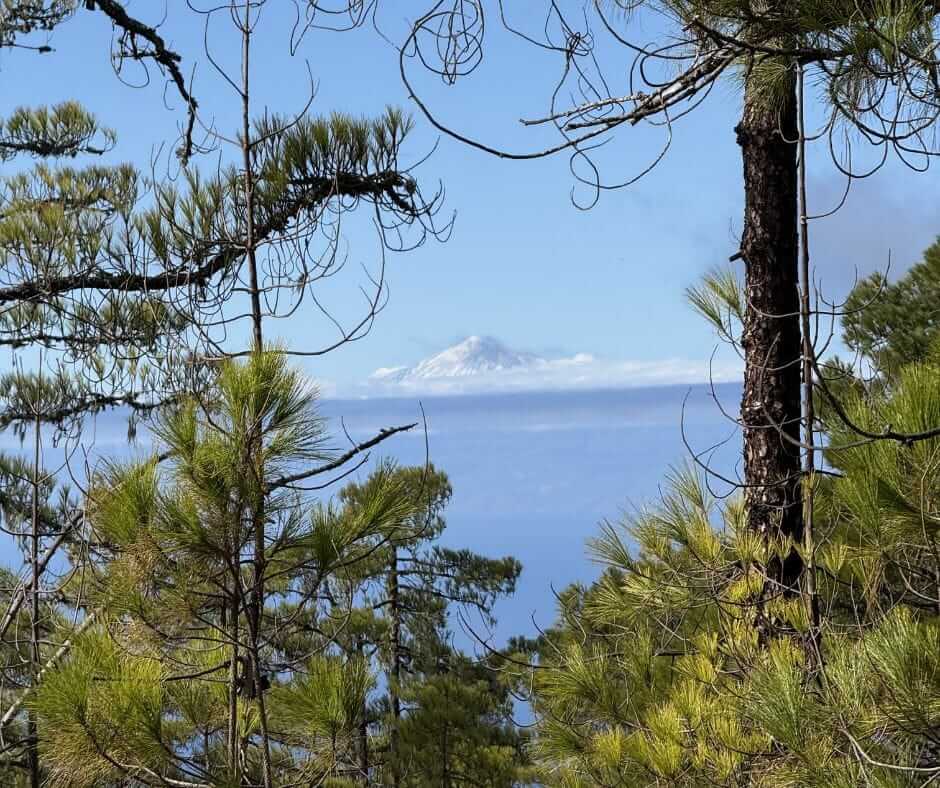
This is one of the toughest days of the GR131. A steady ascent through steep valleys and barrancos, gaining elevation quickly. You need to be fit to make it to Artenara in the same day. It's doable but don't underestimate the climb. The views are amazing. If you're lucky you can even see Teide (the highest peak of Spain, on Tenerife) in the background.
As you climb, you enter Tamadaba Nature Park. This part is worth slowing down for. The pine forests of Tamadaba feel completely different from the rest of Gran Canaria. Cooler air, softer light, quiet trails. Almost a different island. There's a campground in Tamadaba where you can pitch a tent, around 8 km from Agaete.
From here you continue toward Artenara, the highest village on the island. Quiet, raw, and a beautiful place to arrive after that climb.
Where to stay in Agaete / Puerto de las Nieves
- Tamadaba Campground (between Agaete and Artenara): info here
- Hostel: Casa Calma Yoga Hostel (from €24, centrally located in Agaete)
- Mid-range: Hotel Puerto de las Nieves (from €60, with swimming pool, close to trail start)
Where to stay in Artenara
In Artenara it's a bit harder to find budget accommodation, but there are some really cool cave houses.
- Wild option: there's a pretty cool cave a few km before Artenara. I won't share the location publicly to protect it, but I've pinned it on the Ocean Nomads member map.
- Mid-range: La Cuevita de Hilario (from €85, you get a private cave house)
Stage 2: Artenara to Cruz de Tejeda / Tejeda (~12 km)
You're already high, so this day feels different. More space, more views, less effort than the day before. The trail passes Cruz de Tejeda, not Tejeda town. That said, it's worth considering walking and staying in Tejeda. It's often called one of the most beautiful villages in Spain. Tejeda is a small detour from the trail but a great place with more options to stay, eat well, and slow down a bit after the climb. In Cruz de Tejeda, right on trail, there's also accommodation but not budget-friendly.
Where to stay in Tejeda / Cruz de Tejeda
- Budget (Tejeda): Finca la Isa by Rose Mountain House (from €30, slightly off trail, has a jacuzzi)
- High-end (Cruz de Tejeda, on trail): Parador de Cruz de Tejeda (from €90)
Stage 3: Cruz de Tejeda to San Bartolomé de Tirajana (~18-20 km)
This is a longer day. You leave the high mountains and begin the long descent toward the south of the island. The landscape changes. It gets warmer. Drier. More open. You arrive in San Bartolomé de Tirajana, also known as Tunte. Note there's only a very small resupply store here (and a delicious bakery). A small historic town with cafés and slow-living vibes.
Where to stay in San Bartolomé de Tirajana / Tunte
- Campsite: Morro de Santiago is close but not exactly on trail.
- Mid-range: Vista Tunte Camino de Santiago (from €80, close to trail)
Stage 4: San Bartolomé to Ayagaures (~10-12 km)
A quieter, shorter day. Wide valleys, fewer people, and a cool waterfall. Another pretty and very different part of the trail. Ayagaures is a small simple village with a really cool oasis-like area around it. On the square you can find a delicious local meal for a very reasonable price. Check opening hours, the kitchen closed at 17:00 when we were there. We were just in time and so hungry. There aren't many accommodation options, but some. This is probably the most challenging accommodation to fix.
Where to stay in Ayagaures
- Budget: Albergue de Ayagaures. Contact them directly for options. Best bet for a reasonable price.
- Mid-range: Finca Sowilo (from €90, sometimes only 2-day stays, also welcomes volunteers, right on trail)
- High-end: Finca Artemi (from €150, in Ayagaures)
- High-end: MonteCristo (from €250, 1.5 km south of Ayagaures)
Some accommodations only welcome stays of 2+ days, which is something to consider. You can also push through to Maspalomas from here, calculate 3-4 hours more.
Stage 5: Ayagaures to Maspalomas (~13 km)
The last day feels very different again. Drier. Hotter. More exposed sections. You pass some really cool canyons.
Top tip: instead of taking the barranco from Ayagaures straight to Maspalomas, consider Barranco de los Vicentes. That's what we did, and it was epic. Unlike the other barrancos, no road passes through this one. It's wild.
You walk back toward the ocean and finish at Maspalomas. Sand, wind, the sea again. A very different landscape from where you started. Maspalomas is wild too, but in a different way. The end of the trail is at the lighthouse, which is also a museum and worth visiting. It's free.
Enjoy the well-deserved dip in the ocean.
Where to stay in Maspalomas
Maspalomas is a bit of a wild-west holiday resort. Plenty of options. You can also consider leaving town and going to one of the nearby calmer towns.
Recommended links and resources
- Official Gran Canaria campgrounds website and permit application
- GR131 Gran Canaria on AllTrails
- Mapy, my favourite navigation app (download offline maps)
Not sure if you're actually ready for your own thru-hike?
Between Jonatan and me, 10,000+ km on foot. PCT, AT, GR11, Fisherman's Trail, GR131 and more. We made the readiness check we wish someone had given us before our first long walks.
Join my newsletter for more tips and tales on wilder lifestyles:
FAQ: GR131 Gran Canaria
Is the GR131 Gran Canaria well marked?
Mostly yes, with red and white trail markers, but a GPX track or AllTrails download is recommended given there are many trails crossing.
How many days do you need for the GR131 Gran Canaria?
Around 3 to 6 days depending on pace and accommodation. Most hikers take 4-5 days.
Can you wild camp on Gran Canaria?
Not officially. Some hikers do it discreetly, but it comes with responsibility. Designated campsites in Tamadaba and Morro de Santiago are the legal options. Permits are free but must be requested via the Cabildo.
Do you need transport between stages?
No. You can walk the entire island if you plan your route well. There are villages every stage with accommodation and resupply.
Is the GR131 Gran Canaria suitable for beginners?
If you're comfortable with distance and elevation, yes. The first day from Agaete to Artenara is a serious climb, but after that the trail eases. It's a good first multi-day trail if you have a baseline of fitness.
What is the hardest part of the GR131 Gran Canaria?
The climb from Agaete to Artenara is the toughest section, around 20 km with a steep ascent in the first half.
Is there water along the trail?
There are towns along the route where you can refill. After rain you'll find natural water sources. In dry conditions, especially in the south, carry enough water and use a filter.
Can you hike the GR131 Gran Canaria with a dog?
Yes. I hiked it with my dog Wingo in late December. The trail is dog-friendly, the terrain is gentle on paws (rocky in places), and most accommodations along trail accept dogs. Watch the heat in the south sections.
Is the GR131 similar to the Camino de Santiago?
No. It's less structured and more flexible. There's no albergue network like on the Camino. You stay in regular hostels, guesthouses or campsites, and you'll see far fewer hikers.
What is the best time to hike the GR131 Gran Canaria?
November to May. December to March is ideal: mild temperatures, low chance of extreme heat, and fewer crowds. Avoid July and August, the south of the island gets very hot and exposed.
What makes this trail special
What stayed with me most is how much variety you find. You start in green, humid north. You move through mountain ridges and volcanic landscapes. You finish in dry desert near the dunes. And you can do all of it in winter. The contrast between the wild trail and the busy Las Palmas and Maspalomas is something else.
Final thoughts
You won't find a clean stage system or seamless logistics. You won't find too many other hikers (though we met a few). But that's also what makes the GR131 Gran Canaria feel real.
You cross an island. You move through completely different landscapes along the trail. You pass through places that still feel local and quiet. And if you set it up right, you don't need buses or complicated planning. It's worth it. I'd happily hike it again.
If this resonates
Join me on YouTube for more slow travel adventures by sail, van and foot.
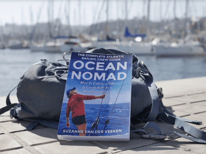
If the ocean is calling more than the mountains, come sail with us. Ocean Nomads is the community I built for people who want to live closer to the sea. Atlantic crossing winter 2026/2027.
For deeper trail reflections, raw logbooks and behind-the-scenes, Patreon is where I share the long-form thinking.
Happy trails. Come find me on YouTube for more stories.
Disclaimer: opinions are my own. What drives me is care for nature, getting you into nature, and encouraging natural living. If you book a place to stay or buy a gear item via the links on this page, at no extra cost to you, a small commission helps me keep creating content about living with and for nature. Thank you for the support.
Related Posts