
Table of Contents
- Day 1: Praia de São Torpes to Porto Covo (10 km)
- Day 2: Porto Covo to Vila Nova de Milfontes (20 km)
- Day 3: Vila Nova de Milfontes to Almograve (15 km)
- Day 4: Almograve to Zambujeira do Mar (22 km)
- Day 5: Zambujeira do Mar to Odeceixe (18 km)
- Day 6: Odeceixe to Aljezur (18 km)
- Day 7: Aljezur to Arrifana (15 km)
- Day 8: Arrifana to Carrapateira (19 km)
- Day 9: Carrapateira to Vila do Bispo (22 km)
- Day 10: Vila do Bispo to Sagres (19 km)
- Day 11: Sagres to Salema (22 km)
- Day 12: Salema to Praia da Luz (11 km)
- Day 13: Praia da Luz to Lagos (10 km)
- FAQ
Updated May 2026. We walked the Fisherman's Trail in 12 days, together with our dog Wingo. In this blog and vlog I share what each day was like. How each day actually felt. What the towns were like when we walked in. And what you'd want to know if you were doing this yourself.
If you're still working out whether to walk the whole trail, my complete Fisherman's Trail Portugal guide has the planning toolkit: 13 stages, costs, where to stay per village, packing list, best time. This post is the diary, day by day, with the practicalities at each stop in case you're booking instead of camping. My partner Jonatan vlogged every day and the videos are below.
Three towns to book first
Most of the trail you can book on the way. Three towns you can't. Salema, Vila do Bispo, and Burgau are tiny, with very few beds, and they sell out fast in spring and autumn. Lock these in 6 to 12 weeks ahead. Booking.com with free cancellation means you can still change your mind.
A note on the accommodation picks
We mostly camped, stayed with Ocean Nomads friends, or pitched in backyards offered along the way. So the per-town recommendations below aren't “I slept there and loved it”. They're the places hikers we crossed paths with consistently named, the highest-rated on Booking.com, and the ones in walkable locations. The maps are there for you to browse and pick what fits your night.
Here's the long version of part one, Praia de São Torpes to Odeceixe, if you want a feel before reading on.
Day 1: Praia de São Torpes to Porto Covo (10 km)
Day one starts at Praia de São Torpes. North end of the beach. There's a first Fisherman's trail map on the north side of the beach. After that, it's blue and green stripes on a wooden post.
We started in the afternoon. About ten kilometres to walk before we ate. Wind in our back, sun off our face. If you can, walk it south. The trail is more pleasant that way in my opinion.
Porto Covo is the first town. So what do you do here. If you're like me and never in a city or place with big food variety, you look for the Indian restaurant. I'm obsessed with Indian food. As a vegetarian the Portuguese food is not my favourite. So we ended up not in Portugal, but in India. Gobi Manchurian, paneer, chicken tikka masala. Five golden stars. Porto Covo has plenty of more restaurants to choose from. Lovely town!
Route from São Torpes to Porto Covo on AllTrails
Porto Covo: where to stay, eat and what to know
Whitewashed clifftop village. A handful of epic cliff kind of beaches a short walk away. Praia Grande, Praia dos Buizinhos, Samouqueira. Fishermen still launch from the harbour. The trail itself even passes a couple of beach bars on the way in and out. Easy place to begin. Nothing too harsh on day one. Many people also choose to start their Fisherman's trail hike here. Ourselves, as rather purists we really wanted to start at the actual trail start.
Practicalities. If you're not camping, browse the map below. Ahoy Porto Covo Hostel is the one most hikers we crossed paths with had booked. Short walk to the beach, shared kitchen, easy for solo budget hikers. Buses from Lisbon Sete Rios via Rede Expressos or FlixBus drop you straight in town. Walk to the Forte do Pessegueiro ruins for sunset. Free, beautiful.
Day 2: Porto Covo to Vila Nova de Milfontes (20 km)
This trail is the longest dog walk of the year. Last year I hiked across the Pyrenees, of which the first 200 kilometers with Wingo. What a dogwalk was that. Now luckily we could share the weight. Twenty kilometres on packed sand at low tide. Long empty stretches. The water looked perfect. It wasn't. Freezing cold!
We met Muhammad on the trail, who'd started the same day from São Torpes. Good company.
By Milfontes we were starving so we went straight to the bakery. That night we slept at our friends Sophie and Mikey's place, the Ocean Nomads who picked us up in their van. We spend the evening sharing adventure stories, making a delicious dinner together and we could enjoy a real mattras. So grateful!
Route from Porto Covo to Vila Nova de Milfontes on AllTrails
Vila Nova de Milfontes: where to stay, eat and swim
It's the biggest village on this stretch, but still small enough that you'll cross it in twenty minutes without trying. Old town on the cliff. River below. Make sure to take a dip! The Rio Mira is what makes Milfontes feel different from the rest. If I had to stay somewhere for a week without moving, I'd pick this one. I could live here!
Practicalities. You don't have to stress-book like in the south. We slept at friends' place this night so didn't try a hostel, but Opa Hostel Milfontes is the one every other hiker we crossed paths with named, and it sits at 9.6 on Booking.com. Padaria A Ceifeira is the bakery I'd send you to, get a pumpkin pie or pastel de nata while you're there. The Mercado Municipal is where the actual fruit and veg are, a little detour from trail. And take a dip in the Rio Mira.
Day 3: Vila Nova de Milfontes to Almograve (15 km)
Sophie and Mikey dropped us back at the trail in the morning. Hot day, lots of sand, lots of sun. Fifteen kilometres of mixed coastal dunes and gravel. Our pace shifts around Wingo, so the day is breaks, water, shade, swims. Distance was never the goal.
In Almograve we found Himalayas, a small Nepali place doing thali and momo. Surprise find in a fishing village. While we were figuring out where to pitch the tent, a stranger invited us to camp behind his house. Outdoor solar-heated shower included. Trail magic.
One of the measures of a good day on a long walk is the number of days you brush your teeth outside. Almograve was one of them.
Route from Vila Nova de Milfontes to Almograve on AllTrails
Almograve: where to stay and eat
Half a dozen streets. A small grocery. The Atlantic right there if you walk down. I wouldn't base here. But for one night on the trail, it works.
Practicalities. We got lucky and met someone who was happy to host us with our tent in his backyard, so we didn't try the hostels. If you want to engineer that kind of luck on your own walk, Campspace does exactly this: books you into private gardens, farms and off-grid pitches up and down the trail. HI Almograve – Pousada de Juventude is the one most readers of this post end up booking (official youth hostel, budget). Almograve Beach Hostel is the mid-range alternative. Eat at Himalayas (Nepalese and so yummy). Browse Almograve accommodation on Booking.com.
Day 4: Almograve to Zambujeira do Mar (22 km)
Solar shower in the morning. Coffee and orange juice in town. You better love coffee places when hiking this trail! Then the prettiest stage of the northern half. Cabo Sardão is the lighthouse on this stretch and the storks build nests on the sea stacks below it, which sounds made up but isn't. They look ridiculous up there. Take it slow.
The cliffs were dramatic and the sun was strong. We found shade under a forgotten beach umbrella halfway through the day and made a small kingdom under it. Diarrasas with cheese for dinner. Dried mushrooms. A few herbs. Beautiful view. Beautiful company.
Route from Almograve to Zambujeira do Mar on AllTrails
Zambujeira do Mar: where to stay (and the August warning)
Small but with more pulse than Almograve. A surf bar or two. Dramatic cliffs on three sides. Festival town: Sudoeste in August is one of Portugal's biggest, and the village is unrecognisable that week. If you're going for that, book a year out. But I don't recommend hiking this trail in August. It's to hot.
Practicalities. Browse Almograve and Zambujeira accommodation on Booking.com, the two villages are close enough that you can compare. Food is hit or miss out of season. Don't arrive hungry and hopeful. The veggie soup of the day is the safe bet in any tasca, cheap and good. There's a small bakery on Rua da Padaria, just a door in the wall, mornings only and you have to be early. Hit it for breakfast before the climb out.
Day 5: Zambujeira do Mar to Odeceixe (18 km)
This is a beach safari kind of day. A fishing harbour with whitewashed houses. We passed Swiss hikers, Americans and lots of Italians. Found what felt like a secret beach. Saw a sand snake disappear into a bush, which I did not enjoy as much as the snake did.
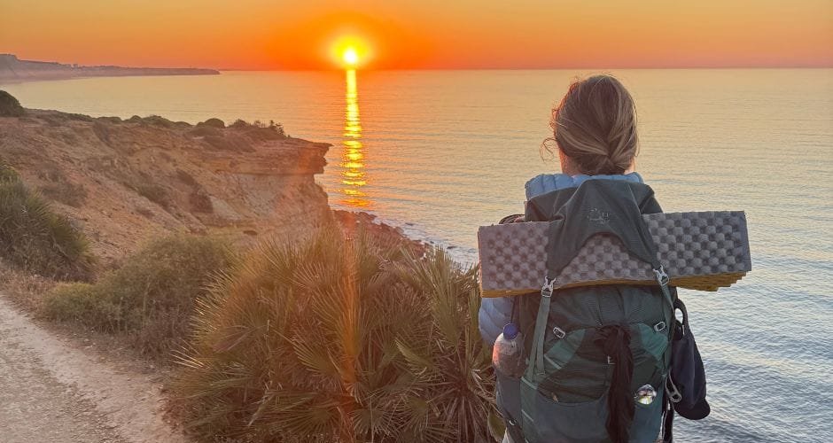
Some of the best beaches on this coast have no roads, no staircase, nothing. Just a tiny footpath dropping down from the trail if you're lucky. Sometimes only a rope, the fishermen use. Climb down and swim when you can as many beaches are often not reachable. You reach beaches that exist only on foot, and that's the magic of this coast.
This was also the day Wingo got attacked by an old farm dog. Everyone was fine, but you got to stay alert. Farm dogs, not heat or distance, are the real risk hiking with a dog on this trail.
The views to Odeceixe beach are amazing! You can either cross the river there (mind the tide), or hike the trail to Odeceixe. It's a bit of roadwalk but Odeceixe is a really cool town.
Route from Zambujeira do Mar to Odeceixe on AllTrails
Odeceixe: where to stay, eat and cross the river
This is where the Alentejo ends and the Algarve begins. The Seixe river meets the Atlantic at Praia de Odeceixe, which is the postcard. Surf shops, a few cafés, a real-village calm. If you're staying a night or two, wade across the Seixe river at low tide between the village side and the south bank. Worth the experience. Be mindful of the moon, new and full mean bigger tidal swings.
Practicalities. Surf Seixe Guesthouse is the most consistent recommendation from hikers we crossed paths with. For early breakfast pastries, Padaria de Odeceixe up the hill is the only place open really early. Maladise café for coffee. Browse Odeceixe accommodation on Booking.com.
Day 6: Odeceixe to Aljezur (18 km)
Up early to catch the sunrise over Odeceixe village. First coffee at Maladise, the only place open before 7am. It is pretty epic to walk through all these Portuguese small villages.
We met hikers from Munich. Refilled water in Rogil halfway through. White horses by the water. A grocery stop, a pelada, on we go. A little water break in the pine forest. Cumin, coriander and fennel seed tea, my belly was a little upset from snacking on random things and the mix calms a bloated stomach right down. Try it, on or off trail.
The Aljezur arrival surprised me. After days of small fishing villages, you walk into a town with a Moorish castle on the hill, a river running through it, and restaurants that actually stay open. I almost skipped Aljezur. I'm glad I didn't.
Route from Odeceixe to Aljezur on AllTrails
Aljezur: where to stay, eat and explore
The Vila Nova de Milfontes of the south. A real town. Old Moorish quarter on the castle hill, white houses, blue trim, river running beneath. The Sweet Potato Festival in November is a real thing, sweet potato is a local crop and shows up on most menus. Try the peixe com batata-doce. If you want a single base for the southern half, this is what I'd pick.
Practicalities. For the wider Aljezur and Arrifana area, HI Arrifana Destination Hostel is the most-booked pick from readers of this post (official youth hostel, budget). The Lighthouse Hostel Arrifana is the clifftop alternative. The Mercado Municipal is the best place for fruit and veg. The Intermarché has van parking and washing facilities, useful if you're driving or need to do laundry. In autumn, if you're lucky, they've got a fresh pomegranate juice machine running. Browse Aljezur and Arrifana accommodation on Booking.com.
Day 7: Aljezur to Arrifana (15 km)
After only one week on the trail, we were blown away by its beauty. It's a fun trail to hike, and it's well signposted. The biggest challenge so far had been the loose sand and the hot midday sun.
Day seven was also the day we left the trail for an afternoon. We met up with my old sailing friend Alistair in Monte Clerigo. We'd sailed in Greece together a year before. He pulled up in his car and took us on a beach safari. A hurricane warning was rolling in. Wingo looked confused. We came back to the trail two hours later and it was still there.
On the trail itself: Praia da Amoreira (point 16 on the map), a compulsory pelada on the beach, watching some volleyball, a swim, a cucumber to balance the sugar.
Route from Aljezur to Arrifana on AllTrails
Arrifana: where to stay and surf
A handful of houses, a few surf hostels, a fortress lookout, a path winding down to the bay. Wind, salt, surfboards, sunset. If you base in Aljezur, Arrifana is a 15-minute drive or short bus.
Practicalities. The Lighthouse Hostel Arrifana is the obvious clifftop one. Aljezur for a real meal afterwards.
Day 8: Arrifana to Carrapateira (19 km)
Cork oaks, inland walking, a few steep ascents and descents, then back to the coast. Long stretches with no food and no water between Arrifana and Carrapateira, so we filled up before leaving.
We thought we'd push further that day. We didn't. Some of the best days on a long walk are the ones where you don't reach for the phone.
Route from Arrifana to Carrapateira on AllTrails
Carrapateira: where to stay between two beaches
Carrapateira is the place between two beaches. Bordeira to the north, the long sandy crescent. Amado to the south, the surf beach. The village sits inland, a small grocery and two surf-shop-cafés worth of activity. Kite surfers come for Bordeira, the wind is reliable. The houses are not.
Don't skip the Museu do Mar e da Terra in the village. Small, free or close to it, full of old fishing tools, cork, traditional rural-life stuff. I almost walked past and shouldn't have. A proper hour of wandering, and the kind of place that gives you a feel for what this coast was before the surfboards.
Practicalities. The village is small and inventory shifts. Browse Carrapateira accommodation on Booking.com.
Day 9: Carrapateira to Vila do Bispo (22 km)
Monday morning, gray and hazy. Tailwind. Mood good. We spotted figs on the trail and ate some of them. Wild figs are easy. There's plenty more to forage if you know what to look for, I wrote about that here. Filled water at a small café (the usual approach). Surf vibes at a beach we passed, a swim, then back on the road. Met Aneta, a hiker from Poland, near the end of the day.
The most useful thing I can tell you about Vila do Bispo is that the Aldi has a working tap in the carpark. That's the level of romance we're working with. Filled bottles. Walked into town. Slept.
Route from Carrapateira to Vila do Bispo on AllTrails
Vila do Bispo: where to stay (book early)
Sleepy, end-of-the-world adjacent. A few restaurants, a pretty whitewashed church, the Aldi. I wouldn't come here for the town.
Practicalities. Algarve Surf Hostel shows up most often. Map below for the rest.
Book Vila do Bispo early
One of the three towns where accommodation books out fastest. Lock it in 6+ weeks ahead in shoulder season. Or sleep in Sagres and bus back for the next morning.
Day 10: Vila do Bispo to Sagres (19 km)
Wingo is not afraid of heights. Today we got to the southwesternmost point of continental Europe. Cabo de São Vicente. The end of the known world. There's a famous hot dog stand at the lighthouse that calls itself the last bratwurst before America. We didn't eat one. Vegetarian on a long walk gets boring fast, I'll grant you, but the romance of standing at the edge of the world with a sausage in your hand is hard to argue with.
The terrain shifts here too. Lunar-feeling rock, exposed cliffs, less green. Take the small detour down to Praia Ponta Ruiva on the way, the view is worth it. By the time we reached Sagres town we were ready for a real meal. We caught up with our friend Phil over coffee and pastel de nata the next morning, which is a more Portuguese way to handle the end of the world.
Route from Vila do Bispo to Sagres on AllTrails
Sagres: where to stay, eat and surf the end of Europe
Low-rise surf town spread between three beaches: Mareta, Tonel, Baleeira. Less manicured than Lagos, more raw. If you want a one-week base with surf schools, sunset capes and a real-town feel, Sagres is what I'd point at. Dog logistics are easy here too.
Practicalities. The Lighthouse Sagres is one that comes up a lot. A Sagres for traditional fish. A Eira do Mel on the road back toward Vila do Bispo for a Michelin-recommended traditional meal. Pão Quente opens early if you need a pastel de nata before you walk. Surf lessons everywhere. The guided Rota Vicentina day hike out of Sagres on GetYourGuide is bookable if you want a one-day trail taste. Sagres or Lagos for a base? Sagres for surf and end-of-the-world drama. Lagos for grottoes. They're 30 minutes apart by bus.
Day 11: Sagres to Salema (22 km)
Wow, wow, wow. This trail keeps surprising us every day.
The hardest stage on the southern half. Continuous ascents and descents in the second half. Multiple beaches strung along the cliffs. At Praia da Ingrina, somehow, someone was getting married on the cliff above the restaurant the day we walked through. Just when you think things cannot go next level. The tide came up faster than we expected and we ended up climbing over rocks. Anyway. Catch of the day at the beach restaurant, then on.
By late afternoon we were walking through pine forest with the smell of resin in the air, past Roman ruins on the cliffs, into Salema.
Route from Sagres to Salema on AllTrails
Salema: where to stay (book first)
Salema is a lovely authentic little town/ The kind of fishing village people draw on postcards. Colourful boats pulled up on the beach. A handful of cliff-side fish places. Pine forest behind. Ruins above.
Practicalities. Salema Eco Camp is the sustainable camping/glamping spot in the pines. The most consistent good mentions go to it. There genuinely aren't many other options, which is the whole point of the warning below. I stayed at Salema ecocamp with my van a few times. Note it's 1.5 kilometer off trail, uphill.
Salema books out fastest of the three
The Eco Camp sells out from spring. The village has maybe eight small guesthouses total. Plan 6 to 12 weeks ahead in shoulder season. Or sleep in Lagos and visit Salema as a half-day.
Day 12: Salema to Praia da Luz (11 km)
Short day. Pine forest at the start, the smell of resin, then back to the coast. Boca do Rio with old Roman fish-salting tank ruins. Almadena Fort ruins on the cliff above. We rolled into Burgau halfway through and stopped longer than planned.
Burgau felt like a film set. A general store with picnic tables outside. Tuk-tuks running tourists between the village and the beach. An ice cream cart. Honestly. It works.
Route from Salema to Praia da Luz on AllTrails
Burgau and Praia da Luz: where to stay and eat
Burgau is squeezed between two cliffs around a tiny beach. Maybe four streets. 200 metres of waterfront. That's the whole show. The third of the three accommodation-scarce towns. Charming. Hard to book. Aloha Burgau is the easy pick. If it's full, sleep in Praia da Luz and walk over for dinner.
Praia da Luz, a few kilometres east, feels different. After 220 km of fishing villages and surf hamlets, Luz is more resort, less raw. A small church near the boardwalk. Sun loungers in neat rows. Restaurants in three languages. The water here is reportedly the warmest on the west coast. Easiest accommodation booking on the southern stretch, which is why families come.
Practicalities. Club House CVL for a budget option in Luz. Map below for the rest.
Day 13: Praia da Luz to Lagos (10 km)
The last day starts with a sunrise walk. Climb out of Luz with a view. Beach turns into boardwalk. Boardwalk turns into the old town. We arrived at the red flag at the end of the trail, with a small statue of the protector of seamen and sailors. Wingo got a bone for finishing 230 km. We had a beer that we'd been thinking about for at least the last 30.
Wingo, you have finished the Fisherman's Trail. This bone is for you.
Route from Praia da Luz to Lagos on AllTrails
Lagos: where to stay, eat and celebrate
The biggest town on the trail by a long way. Walled old town inland. Marina to the south. The famous limestone cliffs and grottoes (Ponta da Piedade) running west toward Praia da Luz. Multilingual menus, hostel scene, surf shops, pavement cafés. It's a cool city!
Practicalities. Lagos City Center Hostel is the easy pick for budget, walking distance to old town and the cliff path. Casinha do Petisco for small traditional food (queue early or book ahead). O Camilo at Praia do Camilo for sea-view seafood. Train to Faro is one hour, bus to Lisbon is 3.5. Map below for the rest.
Want to walk it without sorting accommodation yourself?
Self-guided operators book all 13 nights, transfer your luggage, and give you GPS notes. Browse current self-guided walking tours in Portugal on TourRadar to compare. Portugal A2Z is one local operator I'd look at if their dates work. For luggage transfer only, Vicentina Transfers picks up your bag in the morning and drops it at your next stop for €15 to €20 a stage.
FAQ
When is the best month for the Fisherman's Trail?
April to June and September to October. Mild temperatures, dry weather, smaller crowds. Wildflowers in spring, soft autumn light later. Avoid July and August: no shade, 35°C+. We walked in late September and had close to perfect conditions.
Can I wildcamp on the Fisherman's Trail?
Officially, wildcamping is restricted in the protected Costa Vicentina park. Pragmatically, plenty of hikers do, discreetly. If you go wild, leave no trace, no fires (the region is very dry from April to November and forest fires happen), and stay out of sight.
Is the Fisherman's Trail dog-friendly?
Yes. I walked the full 230 km with my dog Wingo. The sand is gentle on paws. Filter Booking.com for “pet-friendly”. Bring paw wax. Stay alert for territorial farm dogs near villages. They're the real risk on this trail, not the heat or the distance.
What's the shortest version of the trail that's still worth it?
Four days from Porto Covo to Odeceixe (75 km) gives you the wildflower stretch, dramatic cliffs and easy resupply. Or two to three days from Sagres to Lagos (63 km) for the most theatrical Algarve coastline. My complete Fisherman's Trail Portugal guide has the full planning toolkit: stages, costs, where to stay per village, packing list, best time.
Happy Trails!
Stay wild,
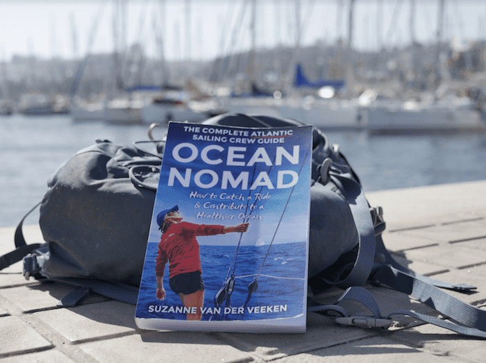
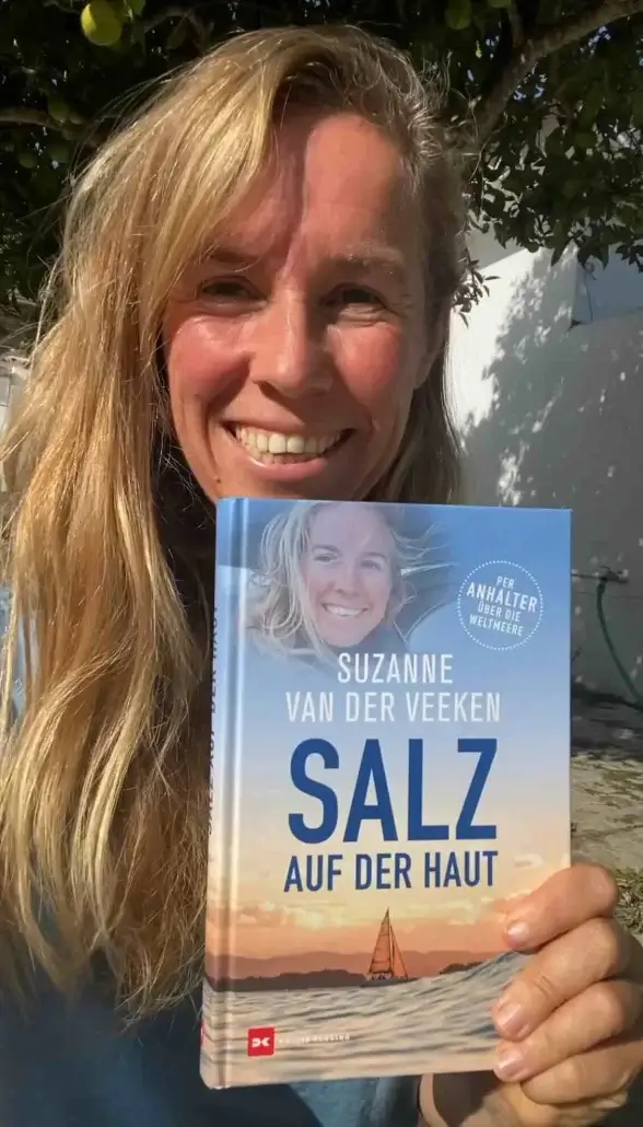
Suzanne
Some links on this page are affiliate links. If you book through them, I may earn a small commission at no extra cost to you. I only recommend places, tours and gear I actually use and trust. Thank you for the support, it helps keep this kind of writing free.