


Table of Contents
- Watch Our Jungle Hiking Film: 12 Days on Foot
- Thru-Hiking in the Caribbean?
- About the Nature Country: Dominica
- About the Waitukubuli National Trail (WNT)
- Gear and Tools for the Waitukubuli National Trail
- Practicalities for Hiking the Waitukubuli National Trail
- Safety and Navigation Tips for the Waitukubuli National Trail
- How to Reach Dominica (and the Trail Starting Point)
- Want to Go Deeper Behind the Scenes?
- Book Your Dominica Accommodation
- Related Reading
Hey wild one. Jonatan and I hiked the full Waitukubuli National Trail in Dominica in 2023. It was a wild, super-rewarding, and epic long-distance trail. In this blog post, I share our experience and tips so you, as a hiking adventurer, can do it too and make it part of your next long distance hiking bucket list.
From experience comes awareness. From caring comes action.
Want the day-by-day story instead of the practical guide? Read my Waitukubuli National Trail Diary for the full trip log of what we ate, where we slept, and what went wrong. This post is the planning guide. The diary is the adventure.
Waitukubuli National Trail: the essentials
- Distance: 180 km across Dominica, south to north
- Duration: 12 days average (that's what we took, no lay days)
- Terrain: Jungle, steep ascents and descents, river crossings
- Best time: December to April (dry season). Late April is mango season, worth timing for.
- Difficulty: Tough but doable for most reasonably fit hikers. Segments 8 and 9 are the hardest.
- Trail pass: $40 USD for the full trail (Forestry Office in Roseau)

Watch Our Jungle Hiking Film: 12 Days on Foot
Curious what this long distance trail actually looks like? We documented our Waitukubuli National Trail adventure on film. Leave us a comment if you watch it. We are super curious who actually does and what makes the trail and film interesting to you.
If the film pulls you in, subscribe to the channel. That's where I share the full raw nomad adventures, from ocean crossings to long trails.
Thru-Hiking in the Caribbean?

As a thru-hiking enthusiast, the Caribbean might not be the first region that comes to mind when you think of your next long-distance hike. However, this tropical paradise is home to a super cool, adventurous long-distance jungle trail crossing the whole country: Dominica's Waitukubuli National Trail.
I tracked our hike with the Garmin inReach Mini to make sure mom wasn't worried. A few times I didn't have battery or forgot to press ‘track', hence the gaps. A detailed map of the Waitukubuli National Trail I haven't found. On Maps.me it was most accurate.

Not many people know about this long distance trail, and I highly recommend it for your next thru-hike. Not many people even know about the paradise country of Dominica (not to be confused with the Dominican Republic). But this hike is being acclaimed as the longest hiking trail in the entire Caribbean region, with a distance of 180 kilometers. Hiking this jungle trail is the most rewarding and also most budget-friendly way to traverse Dominica, the nature island of the Caribbean.

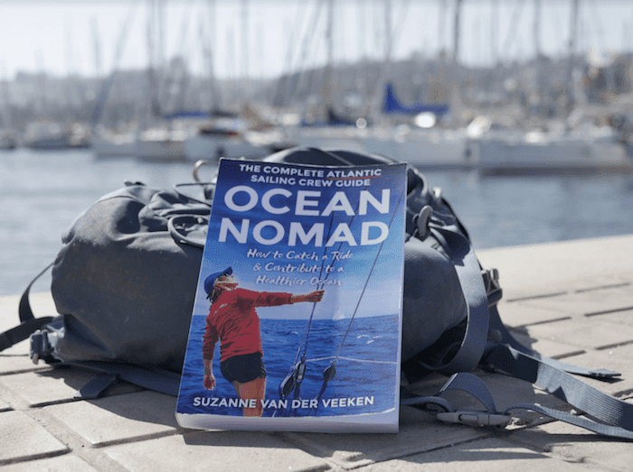
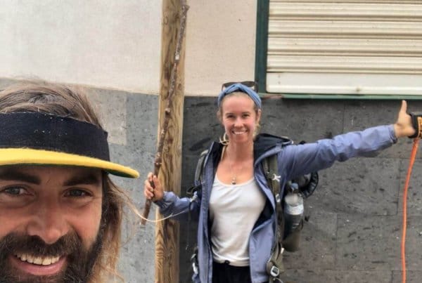
I found out about this jungle trail in 2017, when I was in Dominica, writing my book Ocean Nomad and taking a little break from travelling the oceans and the islands on sailing boats. This was just before Hurricane Maria. And thru-hiking was something I had only experienced once before, hiking the Apu Ausangate when I lived in Peru in 2012. It was not part of my agenda at the time, but a seed was planted in my head. Later in 2017, the country got hit hard by this hurricane, and technically, in the week we planned to set off for the trail, six years later, the full trail had been cleared (thanks Jon and other trail angels!). Some said we were actually the first to hike the full-length trail again in one go. We ended up being in the national newspaper, twice!


This was my sixth long distance trail, and though all of them have been wild, this one was next level adventure, wild, and special. Also for Jonatan, who is a real seasoned thru hiker (Pacific Crest Trail, Colorado Trail, Arizona Trail, GR20 in Corsica, Camino de Santiago, Kingstrail, Annapurna Circuit, and a few more GRs here and there), this trail brought a big smile to his face because of its uniqueness.
You may also like: How I prepared for my first solo hike across the Pyrenees | 850 km GR11

You may also like: 20 Best Hiking Gifts 2025
About the Nature Country: Dominica
Dominica, also called Kubuli Country, is a natural paradise. Dominica lies in the Eastern Caribbean, between Martinique and Guadeloupe. It's small, remote, and doesn't have many flight connections. The best way to reach Dominica is by sailboat. That's how we got here. After some months of being at sea, exploring Dominica is the best way to get grounded, be healthy, and get cultured and natured. My curiosity and desire for some fresh fruits and vegetables after the Atlantic crossing made me stop (and stick) ashore here for about 2 months in 2017. And in 2023 again. It's my favourite Caribbean island, by far.
Dominica is a perfect adventure travel destination for freediving, venturing off the beaten path, hiking, healthy food, waterfalls, hot springs, and nature exploration. The rich soils produce so many exciting foods like banana, papaya, avocado, noni, guava, breadfruit, almonds, and coconuts, as well as spices like ginger, turmeric, cacao, nutmeg, and cinnamon. Dominica is stunning, both above and below the surface. I'm writing this while zipping a tea from lemongrass I picked and dried in Dominica, and spices I brought back from the country.
The best way to discover Dominica: hike it from the south to the north on the Waitukubuli National Trail. Here are some waypoints and tips so you can hike the Waitukubuli National Trail too. Most people can hike it, but it does require some preparation.
About the Waitukubuli National Trail (WNT)
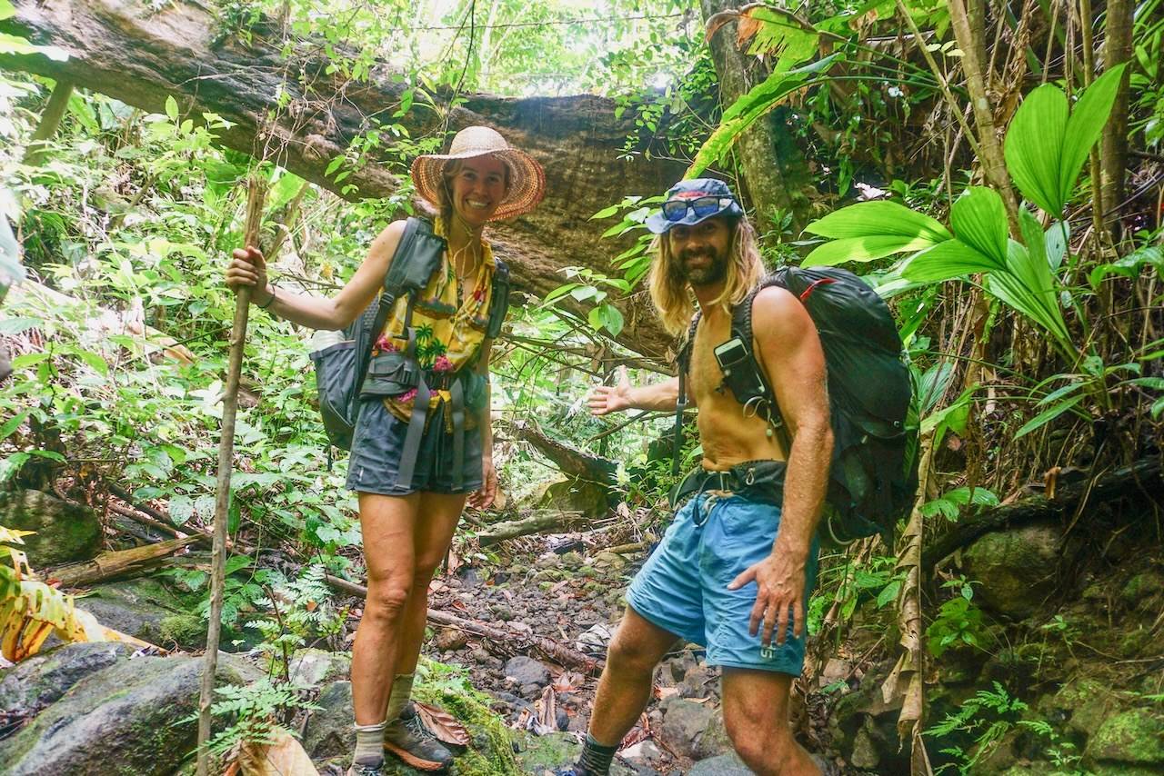
The long distance trail goes from the south of the island to the north. There are 14 segments, which are all totally different, giving spectacular views, rainforests, river dipping, wildlife, local villages, wild fruits, and tropical flora and fauna.
It took us 12 days to complete the full trail, without any lay days. Some sections were overgrown, some markings were missing, some shelters had no roof, and some bridges were compromised. But that also made the adventure raw, wild, and unique.
The WNT Trail and Hurricane Maria
When we arrived in Dominica and asked around for the latest on this promising long distance trail, everyone told us that it's not possible to do the full Waitukubuli National Trail yet. Some sections of the trail have not been cleared. Until we learned from trail angel Jon that now it should technically be possible. He just spent 1 full day clearing a few hundred metres on Segment 8, the last section that was still not cleared since the hurricane.
The trail is still affected. Most bridges, shelters, and information signs are collapsed, but there are ways around it, and it kind of adds to the wildness of the adventure.
Trail Segments

The trail exists out of 14 segments and takes you from the southern to the northern part of the island. Each segment is totally different in length, difficulty, duration, and scenery. It makes them all equally interesting, in my opinion. Prior to each segment, there is sometimes (depending on hurricane damage) an information board with details about the segment. Sometimes the hurricane or sunshine made it impossible to read.
Find extensive descriptions of each segment on the Soufriere Guesthouse website. They are also well documented on AllTrails, each segment separately. You can hike many segments on their own but that requires some logistics going to and from the starting and end points. Hitchhiking is common and accepted and there are plenty of local buses on the bigger roads.
The indicated duration and time to hike on both signs, based on Jon's experience, didn't match our experience. We (read: me) were rather slow and took it easy. Also, we hiked it with the full pack, which day hikers don't take.

Dominica Nature & Wildlife
What wildlife can you expect to see on the Waitukubuli National Trail? Parrots, humming birds, lizards, iguanas, and snakes. As opposed to many other jungle places, and even the neighbouring islands, Dominica doesn't have any poisonous animals. We have come across a couple of snakes but they are said to be not dangerous. Further, no dangerous animals spotted. And surprisingly, there were hardly any mosquitoes either. We saw many parrots. Very special. If you're lucky, you can also spot some whales at Segments 1, 12, 13, or 14.
Water and Food Sources
With hundreds of streams and rivers, sourcing water has been easy. In the first few segments, there are no river crossings, but each village has water supply points. As the trail mostly goes higher up in the country, the water quality from rivers and taps has been good. Though bringing a water filter is smart, especially for the lower segments and village taps.
I use the Katadyn BeFree on trail (lightweight, fast, perfect for hiking) and the Maunawai Kini pitcher back in my van (get 5% off with code OP2020). Full breakdown of both in my guide to water filters for solo hiking.
Food sourcing needs some anticipation here and there. We started off well, having provisioned some basics in Roseau like oats, wraps, almond butter, dates, raisins, and nuts. Also, we made 2 spice and herb mixes to excite the food and keep the digestion healthy. The picnics were brilliant in the first few segments. And then the good stuff runs out :)

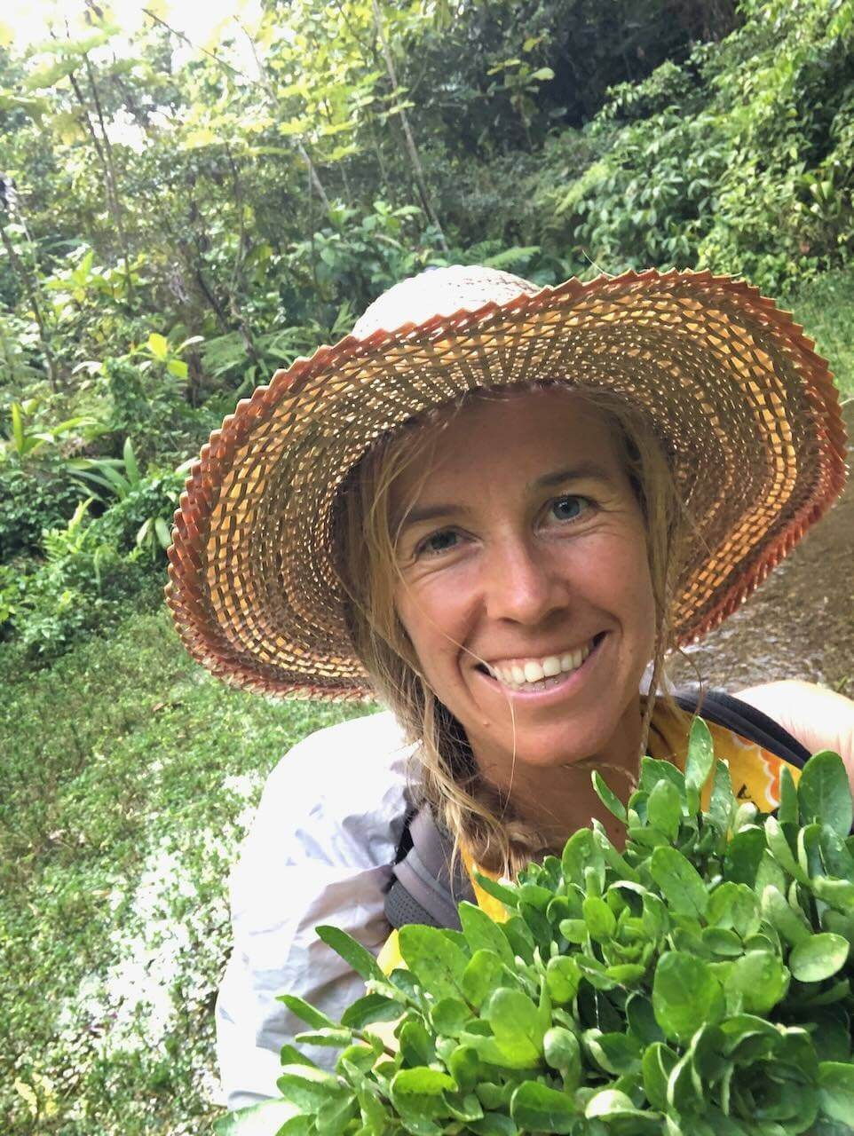
My high hopes for finding lots of wild fruits and superpowers along the way did not let me down. We found a lot of fruit along the way, like guava, water apple, starfruit, wild raspberry, and coconuts, which for me was a super exciting part of the hike. Reaching watercress river on segment 8 was a happy arriving-to-paradise moment (see film).


If you like chicken and bakes, you're not going to have a problem finding food in the villages. As a vegetarian, on the other hand, I had a bit more scouting to do. On a few occasions, the lady in the local food shack was happy to make a veggie edition of whatever she was selling. Often greasy.
Now and then we came across a food stall selling bananas, cucumbers, tomatoes, carrots, and sometimes some other fruits or veggies. But this did not happen often. Grab your chances when you spot it.
In Wotten Waven (Le Petit Paradis), I found my first home cooked meal, which was priceless. As well as jumping in the hot spring there, after a full day of hiking.
Main Tips for Food & Water Re-supply on the Waitukubuli National Trail
- Don't carry too much water. You'll find it. Just make sure to have enough on Segment 8 (and then refill at Melville Hall River for the hike up to Mosquito Mountain). Be careful with taking water when in lower sections (Segment 10 for example). Or filter it.
- Start off the hike with some basic trail food provisions you can find in Roseau (Astephans and the Local Market). Along the way you'll find shops but they are super basic. Mostly catering processed stuff (cookies, chips, some canned food, sometimes bread). Sometimes they have instant noodles too. The best food we found in the food stalls, freshly prepared. However, often it's fried and with meat. You'll survive but as a vegetarian, it's a little more complicated.
- Hike when mango season starts (April). It'll be raining mangoes.
- Bear in mind shop opening hours when entering villages (I don't remember them exactly, ask around).
- Stock up well in the Kalinago territory, segment 6, for the next segments ahead. At Segment 11, you can find food again. You'll find something to forage on the way as well (watercress, yum yum).
- Learn about what you can eat from nature. And what the fruit trees look like from a distance. The trail provides a lot of wild fruits but you do need to be able to spot it. It's not always obvious.
- Meet and greet locals. On numerous occasions, we've been invited into people's homes and got served home cooked meals, coconuts, bananas, more coconuts, and other yumminess. Priceless. In Le Petit Paradis (End of Segment 3 / Beginning of Segment 4) and at Danglez Bed & Breakfast Homestay (Segment 6), I had a delicious non-greasy home-cooked meal.

Gear and Tools for the Waitukubuli National Trail

Locally, finding hiking gear is hard, if not impossible. Bring in advance what you may need. But for this hike, you really don't need much. What you do need is rainproof shelter.

What we brought from overseas: tent, summer sleeping bag, sleeping mat, and trail shoes.
I didn't have a brilliant backpack, so I used the camera gear bag instead. I also didn't have a light waterproof jacket, so I brought my sailing jacket. It served as a pillow, too :). I wasn't sure if I should bring it or not, given the weight, but I'm really happy I did. Sometimes it rained, and it was a little bit chilly.
If you're planning a trip now and need a proper thru-hike backpack (I've learned my lesson), check out my Osprey Eja 48 review. It's what I've used on every big hike since.
Caribbean-specific gear tips
- Reef-safe sunscreen is essential here. Dominica's reefs are protected and chemical sunscreens damage coral. See my guide to reef-safe biodegradable sunscreens. Bring enough, you won't find it easily in Dominica.
- Trail runners with good grip work better than heavy hiking boots in the humid jungle. Your feet will thank you. My current favourite: Topo
- Merino wool socks, and bring two pairs. They dry fast, resist smell, and don't shed microplastics in the water (which you'll be crossing a lot).
- Portable power bank (ideally solar) is crucial. Charging points are hard to find on the remote segments. Nitecore has the lightest powerbank option.
- A proper rain jacket beats a sailing jacket on weight. I should have invested. I used a very old sailing jacket which has been fine. These days I use the Patagonia 3layer jacket.
- Full hygiene kit tips in my trail hygiene guide. Jungle humidity makes this extra important.
Gear tip: Get 15% off a Sea to Summit sleeping pad
Use code SLEEPINGMAT15 at checkout. Shop Sea to Summit here.

Therm a Rest Neoair Sleepingpad
- Ultralight (330 grams for Regular Small 168cm)
- Compact
- Insulates well
- Super comfortable
- Available in different sizes
Here's a video where I walk through my gear pack for this Caribbean hike. You don't need any fancy hiking or climbing gear. On the tough segments, there is rope work that we have found in good condition.


We had simple trail sneakers, 1 set of clothes, a few underwears, a few bottles to refill, and a hat (I got a hand-made one in the Kalinago territory).
See here my favourite hiking gear.

Osprey Eja 48 Backpack
Practicalities for Hiking the Waitukubuli National Trail
How long does it take to hike the full trail?
It took us 12 days without any lay days. We took it easy. You could do it faster but with so much beauty along the way, you'd miss out. We stopped for swims in waterfalls, foraging for wild fruit, zipping coconuts at farmers, and having a home cooked meal here and there. Sometimes food sourcing required a little detour. And we made a few ghost miles because of missing a trail sign. A few times we sought shelter from the rain, causing some delays. Don't underestimate segments 8 and 9. Those are the toughest and took us way longer than said on the trail segment indications. The distance and time often presented on the signs and flyers were quite inaccurate and usually too optimistic for us. I think they are focused on people without carrying a backpack. Take your time for the trail. It's a once in a lifetime experience. I wish it was longer when we arrived at the end.
After the WNT, I did my first long distance solo hike. In summer 2024 I hiked 850 km across the Pyrenees with my dog. I'm publishing videos about it on YouTube. Subscribe and join me.

When is the best time to hike the Waitukubuli National Trail?
The best time to hike the WNT is during the dry season, from December to April, when the weather is less rainy and the trails are more accessible. We hiked the trail at the end of March and early April, and the weather was perfect. At the end of April, mango season starts, and this good addition adds extra pleasure to the trail.

Do you need a trail pass?
You can purchase a trail pass from the Dominica Forestry, Wildlife, and Parks Division. This office is based in Roseau, and we only learned about that later. The pass costs about $12 for a single segment or $40 for the entire trail. Hopefully the funds go to fixing some of the trail. You can't buy a trail pass on the trail itself.
Safety and Navigation Tips for the Waitukubuli National Trail


Garmin Inreach Mini2
- Don't hike the Waitukubuli National Trail alone. If you do hike a segment alone, always let someone know where you are. Logistically, Segments 1, 2, and 3 are fairly easy to do as stand-alone segments.
- Check for the yellow and blue trail markers often. Especially in the beginning, it was not always well marked, or we just didn't look well enough, which resulted in a few searches and detours.
- Download the map of Dominica on Maps.me. The trail is pretty well marked there.
- Download AllTrails. There's a semi accurate WNT trail on there, except for segment 8. It's well worth paying for the subscription (try AllTrails for free).
- Save your battery where you can and bring a portable charger or extra battery. It's not easy to find places to charge.
- Carry a satellite device for extra safety (and activate and test it before).
- Make sure someone knows which segment you're on each day.
- Don't have a siesta under a coconut tree.
- Check the weather, especially when planning to camp next to a river (Melville Hall river on segment 8, for example).
Stay your first night(s) at the Soufriere Guesthouse and inform yourself by Jon on the latest of the trail.
Where to sleep on the trail: tent or hammock?
If you want to hike the full trail, bring your own sleeping equipment. Segments 7, 8, 9, and 10 are remote without any further facilities. We had rain almost every night.
Camping spots are to be found, but not always around the corner. A few times we slept in a garden with a local. The best camp spots are to be found on the trail, not at the beginning or end of the segments.
There are some shelters along the trail. However, most of them have either a picnic table so you can't pitch your tent, or are collapsed. It's mostly nice for your picnic breaks.
Best Accommodation on the Waitukubuli National Trail
If you want to do part of the trail and sleep in an accommodation on the Waitukubuli National Trail, here are some budget-friendly accommodation recommendations in Dominica on or near the WNT.
End of Segment 1 / Beginning of Segment 2: Soufriere Guesthouse. Make sure to talk to Jon for the latest trail info.
End of Segment 2 in Bellevue Chopin: To my knowledge, no places to stay. You can take a bus or hitchhike down to Loubiere or hike a little more and stay in Giraudel, the village after Bellevue Chopin.
End of Segment 3 / Beginning of Segment 4: Le Petit Paradis (yummy home-cooked meal). And make sure you jump in one of the hot springs. You can pitch your tent here, take a hammock, or just roll out your mat under the roof.
End of Segment 5: You could stay in Castle Bruce.
End of Segment 6 / Beginning of Segment 7: Hibiscus Valley Inn (not exactly on the trail). I have not stayed here, but I was here. It looks awesome and the food is super yummy.
Segment 6 (Kalinago territory): Danglez Bed & Breakfast. Homestay rooms and delicious home-cooked meals. We pitched our tent in his garden. Perfect to charge devices, take a shower, have a healthy dinner and breakfast, and a zero-waste trail snack (see film). Say hi to him from me.
Segments 8 and 9: No places to stay. Bring a tent.
End of Segment 10: Stay in Picard.
Segment 12: Sunrise Inn, close to the trail in the village of Pennville.
End of Segment 14: Stay in Portsmouth, the end of the trail.
Our last night we found a secret beach, made a campfire, and camped here:
How to Reach Dominica (and the Trail Starting Point)

What makes the trail extra special is that Dominica is remote (for now, an international airport is in the making). You can reach Dominica via a local flight from a neighbouring Caribbean country. At the moment, there's only one long-distance flight from Miami to Dominica. Other options are flying into Guadeloupe or Martinique and then taking the ferry to Dominica. Condor often has good deals. The very best and most exciting way to reach Dominica is by sailboat. No boat? No sailing experience? No worries. You can travel by sailboat as crew. Here are some tips:
- Here are some blogs about travelling by sailboat.
- Here is a book I wrote about sailing across the Atlantic as crew.
- You can join the Ocean Nomads community to figure out the logistics on sailboat travel and find boats and sailing buddies, and to find more info on how things work in wild remote places like Dominica. We have many members who've passed through with lots of tips and are always happy to help. We even have another Waitukubuli trip report on the network now.
- And here is my most recent toolkit: a course on travelling by sailboat. 40,000 miles of sailboat travel experience condensed into a video course to help you travel by sailboat, safely.

My best tip on hiking the Waitukubuli National Trail: go for it. And make sure you have the time to do the full long distance trail. On the whole trail, we met 2 other hikers who were aiming to do the full hike. Only they couldn't finish because they had a flight to catch. A pity.


Thank you trail angels. And my angel Jonte for carrying the tent, food, and support when things got tough. The people who came out to the trail, or people we met in the villages, who refreshed us, greeted us, shared information, fruit, and food, and essentially brought the trail magic to us.

What do you think? Are you excited about hiking the Waitukubuli National Trail? Or have you hiked it? Drop a comment below this post or on our film 12 Days on Foot. We're happy to give some waypoints and support.
Want to Go Deeper Behind the Scenes?
We have quite some footage that didn't make it into the movie, and is too raw, real, or intimate to share publicly.
On my Patreon you can find a playlist with more raw footage and behind the scenes about the trail, as well as the raw recording of the interview with the national newspaper.

Book Your Dominica Accommodation
Booking.comThis post contains affiliate links. If you book Dominica accommodation or purchase something through these links, at no extra cost to you, I earn a small commission that helps me keep investigating, exploring, and creating content about living an adventurous, natural nomad life. I only recommend places and gear I've personally experienced or researched thoroughly. Splash thanks.
Related Reading
- Waitukubuli National Trail Diary: the day-by-day trip log (the adventure, not the planning)
- I Hiked 850 km across the Pyrenees: my solo thru-hike with my dog on the GR11
- Ultralight Thru-Hiking Gear List for Women: my 7 kg setup
- Osprey Eja 48 Review: the backpack I wish I had on the WNT
- Best Hiking Apps for Thru-Hiking: what I actually use on trail
- Trail Hygiene Guide: how to stay clean(ish) in the jungle
- Reef-Safe Biodegradable Sunscreens: what to pack for the Caribbean
- Freediving in Dominica: if you want to explore underwater after the trail
- How to Sail the Atlantic as Crew: the most adventurous way to reach Dominica
Related Posts


Hey Suzanne!
Greetings from India. I read your blog: https://www.theoceanpreneur.com/nomadlife/waitukubuli-national-trail-longdistance-hike-jungle/
I am planning a honeymoon with my partner to Carribbean islands. One of the destinations I want to visit is Dominica. And I want to walk this trail. But I don’t think I will have that many days in Dominica. Perhaps, only a week. Out of 14 segments, if you could recommend me the most beautiful parts, crossing through jungles, rivers and waterfalls, what segments would you recommend me? Can you please help me in recommending? I have trekked previously in the HImalayas so I won’t have problem with steep hikes. But my partner would only prefer treail section with moderate deiffulcty. Both we both are fit and healthy, and can hike for some distance.
Awesome honeymoon destination :) It’s hard to choose a favourite segment. Each one is unique on it’s own. 1,2,3 are very beautiful but the first river crossing was only in segment 3 if I remember correctly. Segment 4 has lots of river and waterfall excitement and is very jungle like. You could take a detour too to the Middleham falls which is spectacular. In Wotton waven where the segment starts you have sulfur springs which are very romantic:) We stayed at Petit Paradis. At the end of Segment 4 there is a big round about from which you can take a bus to wherever you sleep, or camp and continue for Segment 5. 6 passes through the Kalinago territory which is also very special. We were welcomed there for coconuts and homemade meals. I could also highly recommend the Boiling lake hike. It’s very special and if you’re fit you can do it. Enjoy the honeymoon! Which other islands are you visiting?
Saludos from Spain
Ps. It’s my dream to go to India!
Hi Suzanne. My wife and I plan to hike the Waitukubuli trail in Apr 25. We have downloaded the existing segment gpx files from All Trails. I wondered if you would be kind enough to share your gpx file for your hike please? TIA Craig
Hey Craig! Awesome you are going to hike it! I don’t have a GPX file. My Garmin Inreach was out of battery now and then so I don’t have a proper recording of the trail. Make sure to bring an extra battery to charge :) Enjoy! Let me know if you document the trip somewhere. Would love to follow.
Hi! i’m glad and sad to see that someone has recently thru-hiked the trail. i had visited Dominica on a sailing trip in 2014 and always wanted to go back, then i finally did, attempting the trail solo in 2022, starting from the north, and i became lost in segment 10, maybe? Bloodied by razor grass and lost in a mountain i sadly had to turn back, and then did a couple sections here and there, completing a total of half the trail. I’m headed back this year to proper thru hike the whole trail the correct way. I haven’t read your whole blog yet but look forward to it.
Hey! Thanks for the comment! How cool you know and attempted the hike and go back to complete :) It’s a very special experience. The razor grass was a bit brutal indeed. Long pants helped :) More people seem to walk it now so hopefully it’s fine. Happy to help may you have further questions after reading this blog. I may post another video about the trail on YouTube too with some tips :) Enjoy!
Hi Suzanne
My friends and I will be hiking the WNT next month! Super excited! We have found your blog SO useful. So thanks a lot!
You say you did the 14 WNT segments in 12 days. Which segments did you combine? I tried to find this info on your website but may have missed it!
Thanks!
A
How exciting! So we camped on the trail and mostly just walked how we felt. We were not particularly fast. The only segment I remember is important to time well is 8, because you can only camp and source water at Melvin Hall river. But you can also just do that in a day. Are you documenting your trip? Would love to follow! Enjoyyy and say hi to Jon in Soufriere guesthouse from Jonatan & Suzanne He knows the trail very well
Hello Suzanne,
Thanks so much for this resource, it has been a huge help in planning our trip to Dominica!
My girlfriend and I are planing on hiking the first 3 sections of the trail and staying at Soufrierie and Le Petit Paradis. We’re hoping to avoid carrying full camping gear so we’re hoping to find somewhere with a bed and a bathroom at the end of section 2 (somewhere in Bellevue Chopin).
Do you have any recommendations on places to stay? Or would you happen to have a local contact that we could ask? There are not a ton of options popping up.
Really excited! Thanks again :)
Hey Jackson! Thanks for the comment! Glad it helped. At the early beginning of segment 3 we camped at a locals house who invited us to pitch the tent in his garden. He was building some sort of accommodation for hikers. It’s about 1 KM on the trail. Unfortunately I can’t find a contact. You can also try Nature’s retreat Dominica though I’m not sure it still exists? An option could be taking the bus down and up to Loubiere or make it to the next village of Giraudel if you’re not a very slow hiker :) Enjoy!!
Say hi to Jon & Amy at the Sourfriere guesthouse from me (Suzanne) & Jonatan.
Hi Suzanne! (reposting this as the formatting looked off in the previous one)
We completed the WNT! Woohoo! Thanks so much for the recs, especially to reach out to Jon at Soufrière Gueshouse. He was a wealth of knowledge.
I thought it would be useful to provide a quick summary for those who come to your website interested in doing the WNT.
Our most important advice would be: DO NOT DO THE WNT IN JANUARY. Despite being the start of the dry season, we got hit with a lot of heavy rains which made parts of the trail impossible and super dangerous, especially segments 8 and 9, which are the most difficult. Made for quite the experience though! :)
WE RECOMMEND DOING THE WNT FROM MARCH TO MAY.
We completed the hike in around 12 days, though some sections were only partially completed either due to weather conditions or by skipping road sections by hitch-hiking. I’ve summarized some bits below. Note that our times may be longer than usual because of the wet conditions. This hike would be much more fun if dry!
Segments 1 and 2: We combined these in a single day. Took us around 7h.
Segment 3: Took us around 7h Segment 4: We had to take the opt out to Cochrane (around Middleham falls) due to heavy rains. A beautiful hike when not raining heavily.
Segment 5 and 6: Hiked to Emerald pool which is definitely worth a visit. As the rest is a lot of road walking, we hitch-hiked most of it. Hitch-hiking is super easy and you get picked up pretty quickly (usually by pick up trucks).
Segment 7 and start of 8 (until Melville River): We combined these because it’s important to have enough time for the rest of 8 (which is among the most challenging bits of trek). That being said, the start of segment 8 (from first camp to Melville river) is amazing. The trail is hard to find at points but it’s relatively flat and the experience of being deep in the jungle is indescribable. I would even recommend doing that as an out-and-back day hike which should take 4-6h.
Segment 9: We unfortunately had to opt out to Colihaut because of heavy rains. Really tough bit of trail. Mostly steep descents and ascents for a while.
Segment 10 and 11: S10 is super easy and may be worth combining with a quick trip to Syndicate Falls. We went until Picard and did not do the section from Picard to Bornes as locals advised against it.
Segment 12: Sections were quite overgrown with razor grass. We opted out at Vielle Case and took the local bus to Penville for the start of S13. Super fun bus ride!
Segment 13: Lovely bit of trail with nice views.
Generally, we found the trail not very well maintained and without a GPS map, impossible to navigate, especially in segments 8 and 9. Some sections (in segments 3, 9, 11 and 12) were very overgrown and required a cutlass to pass through, razor grass being the worst of the culprits. We had a few days of heavy rains, despite being at the start of the dry season. In those days, the trail became extremely dangerous. As mentioned in the table, we had to opt out twice (in segments 4 and 9). We were lucky to avoid rain during segment 8. Segment 9 under heavy rain was a death trap. Entire bits of the trail would crumble under our feet while the rest was mostly steep and muddy descents without any ropes to assist.
Segment 13 is by far the most enjoyable bit of hiking. It is extremely well maintained, safe and fun. Segment 13 could be used as the model for maintenance efforts. Having reach the most northwest point of the island, we did not attempt segment 14, especially as we were told it was mostly road walking.
It was a super memorable experience and I personally fell in love with the island and the hike. If you want to feel like an explorer immersed into nature and don’t mind some rough conditions, this hike is right for you!
Cheerios
A
PS: if anyone wants more info, I am happy to share it. Just add a comment to this thread :)
Oh and Jon from Soufrière Guesthouse is probably the most useful contact to have if you’re interesting in doing the WNT. The guesthouse’s website has the most up-to-date info on the WNT: https://soufriereguesthouse.com/waitukubuli-national-trail/